Cape York Peninsula (biogeographic region)
| Cape York Peninsula Queensland | |||||||||||||||
|---|---|---|---|---|---|---|---|---|---|---|---|---|---|---|---|
 | |||||||||||||||
| Area | 122,564.57 km2 (47,322.4 sq mi) | ||||||||||||||
| |||||||||||||||
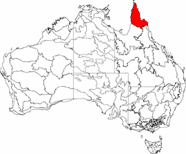
Cape York Peninsula (code CYP),[1] an interim Australian bioregion, is located in Queensland.[2]
Along the eastern margin, the geology of the Coen-Yambo Inlier is complex, with volcanic, metamorphic and acid intrusive rocks.[3] This area includes high-altitude/high-rainfall areas.[3] The subregion of theBattle Camp Sandstones, formed from deeply dissected plateaus, lies in the south of the region,[3] with the Laura Lowlands, composed of sands and silts, and colluvial and alluvial clays, lying adjacent.[3] The west of the region is dominated in the south by an extensive Tertiary sand sheet dissected by the drainage systems of the Holroyd Plain, the Tertiary laterite of the Weipa Plateau, and the low rises of Mesozoic sandstones, while the northern section consists of the Weipa Plateau together with extensive coastal plains along the Gulf of Carpentaria. To the east lie aeolian dunefields.[3]
The vegetation mainly consists of woodlands, heathlands, sedgelands, vine forests (including both semi-deciduous vine forests on the eastern ranges and deciduous vine thickets on western slopes). Mangrove forests are found in the north east and along the estuaries on the coasts.[3] The climate is tropical, humid or maritime, with rainfall varying from 1000 mm to 1600 mm.[3]
Regions
In the IBRA system Cape York Peninsula has the code of (CYP), and has nine sub-regions:[4]
| IBRA regions and subregions: IBRA7 | ||||
|---|---|---|---|---|
| IBRA subregion | IBRA code | Area | ||
| ha | acres | |||
| Coen-Yambo Inlier | CYP01 | 2,312,126 | 5,713,390 | |
| Starke Coastal Lowlands | CYP02 | 512,498 | 1,266,410 | |
| Cape York-Torres Strait | CYP03 | 94,367 | 233,190 | |
| Jardine-Pascoe Sandstones | CYP04 | 1,444,223 | 3,568,750 | |
| Battle Camp Sandstones | CYP05 | 504,409 | 1,246,420 | |
| Laura Lowlands | CYP06 | 1,791,228 | 4,426,220 | |
| Weipa Plateau | CYP07 | 2,848,753 | 7,039,420 | |
| Northern Holroyd Plain | CYP08 | 2,464,074 | 6,088,860 | |
| Coastal Plains | CYP09 | 284,780 | 703,700 | |
See also
References
- ↑ "Interim Biogeographic Regionalisation for Australia (IBRA7) regions and codes". Department of Sustainability, Environment, Water, Population and Communities. Commonwealth of Australia. 2012. Retrieved 13 January 2013.
- ↑ "Interim Biogeographic Regionalisation for Australia, Version 7: regions" (PDF). Retrieved 6 May 2018.
- 1 2 3 4 5 6 7 Environment Australia. "Revision of the Interim Biogeographic Regionalisation for Australia (IBRA) and Development of Version 5.1 - Summary Report". Department of the Environment and Water Resources, Australian Government. Retrieved 6 May 2018.
- ↑ "IBRA7 subregions and codes" (PDF). Retrieved 6 May 2018.