Cape Sōya
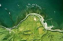
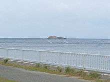
Cape Sōya (宗谷岬 Sōya-misaki) is the northernmost point of the island of Hokkaidō, Japan. It is situated in Wakkanai, Sōya Subprefecture. The Monument of the Northernmost Point of Japan (日本最北端の地の碑) is at the cape, although the true northernmost point under Japanese control is a small deserted island called Bentenjima, 1 km northwest. Since the cape is just 43 km away across La Perouse Strait from Cape Crillon, Sakhalin Island, Russia, it is possible to catch a glimpse of the island of Sakhalin on a clear day.
There are more than ten monuments at Cape Sōya, including the Monument of the northernmost Point of Japan, the Tower of Prayer (a memorial to Korean Air Lines Flight 007, shot down in 1983), a statue of Mamiya Rinzō, the Monument of Peace (a memorial to the sunken submarine USS Wahoo, and others.[1] Sōya Misaki settlement, east of the cape, has many facilities known to be "the northernmost in Japan", such as the northernmost lighthouse (Cape Sōya Lighthouse), the northernmost filling station (Idemitsu Cape Sōya SS), the northernmost elementary school (Ōmisaki Elementary School), and so on.
Monument of Peace
On the site of Cape Sōya stands the Monument of Peace, a memorial to the USS Wahoo, sunk with 80 men aboard on October 11, 1943, as well as 5 Japanese merchant ships sunk with 690 people, attacked by Wahoo. The inscription on the memorial reads in part:[2]
When the Wahoo was lost it was the highest-scoring submarine in the U.S. Navy. Eighty Americans sleep in the Soya Strait 12 miles northeast of here. Many Japanese sleep in the Sea of Japan from Wahoo attacks. This monument was erected by the members of the Japanese Attack Group and relatives of Americans lying in the Wahoo. Old enemies met as brothers to ensure that our countries will have lasting peace and war will never again destroy the friendship we enjoy today.
— George E. Logue
The exact position of Wahoo was confirmed by a dive team from the Sakhalin Energy Investment Company Ltd in July 2006.
See also
| Wikimedia Commons has media related to Cape Soya. |
References
- ↑ "Archived copy". Archived from the original on 2007-10-29. Retrieved 2007-10-14.
- ↑ "Archived copy". Archived from the original on 2007-09-28. Retrieved 2007-10-14.
Gallery
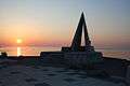 Sunset
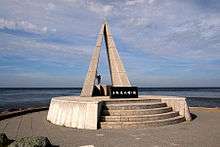 Monument of the northernmost Point of Japan
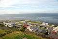 A view from a hill nearby
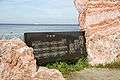 The "Music Monument" which automatically plays the song Sōya-misaki each time a visitor stands in front
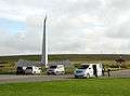 The Tower of Prayer, a memorial of Korean Air Lines Flight 007
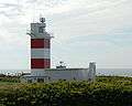 Cape Sōya Lighthouse
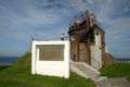 The observatory, used by the Imperial Japanese Navy to monitor the strait during the Russo-Japanese War
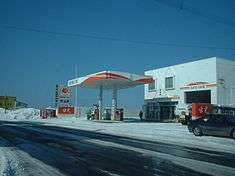 Idemitsu Cape Sōya SS, the northernmost filling station
 Sōya Junior High School, the northernmost junior high school
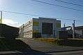 Ōmisaki Elementary School, the northernmost elementary school
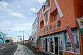 Vista of "northernmost" shops
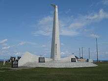 The Tower of Prayer
 A map of Cape Soya in April 2014
Coordinates: 45°31′22″N 141°56′11″E / 45.52278°N 141.93639°E