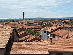
Candelo
| Candelo | ||
|---|---|---|
| Comune | ||
| Comune di Candelo | ||
 | ||
| ||
 Candelo Location of Candelo in Italy | ||
| Coordinates: 45°33′N 8°7′E / 45.550°N 8.117°E | ||
| Country | Italy | |
| Region | Piedmont | |
| Province | Biella (BI) | |
| Government | ||
| • Mayor | Giovanni Chilà | |
| Area | ||
| • Total | 15.1 km2 (5.8 sq mi) | |
| Elevation | 340 m (1,120 ft) | |
| Population (30 September 2010)[1] | ||
| • Total | 8,060 | |
| • Density | 530/km2 (1,400/sq mi) | |
| Demonym(s) | Candelesi | |
| Time zone | UTC+1 (CET) | |
| • Summer (DST) | UTC+2 (CEST) | |
| Postal code | 13878 | |
| Dialing code | 015 | |
| Website | Official website | |
Candelo is a comune (municipality) in the Province of Biella in the Italian region Piedmont, located about 60 kilometres (37 mi) northeast of Turin and about 4 kilometres (2 mi) southeast of Biella.
Candelo borders the following municipalities: Benna, Biella, Cossato, Gaglianico, Valdengo, Verrone, Vigliano Biellese.
Main sights
- The Ricetto di Candelo, a fortified storehouse
- Church of Santa Maria Maggiore (12th century)
- Church of St. Lawrence, of medieval origins but remade in Baroquestyle in the 18th century
- Ysangarda, a medieval archaeological site in the Baragge natural area.
References
External links


This article is issued from
Wikipedia.
The text is licensed under Creative Commons - Attribution - Sharealike.
Additional terms may apply for the media files.