Camden, Arkansas
| Camden, Arkansas | ||
|---|---|---|
| City | ||
| City of Camden | ||
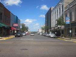 Downtown Camden | ||
| ||
| Motto(s): "Star of the River" | ||
 Location of Camden in Ouachita County, Arkansas. | ||
| Coordinates: 33°34′15″N 92°50′6″W / 33.57083°N 92.83500°WCoordinates: 33°34′15″N 92°50′6″W / 33.57083°N 92.83500°W | ||
| Country |
| |
| State |
| |
| County | Ouachita | |
| Township | Ecore Fabre, Lafayette | |
| Incorporated | 1844 | |
| Government | ||
| • Type | Mayor–Council | |
| • Mayor | Marie Trisollini (I) | |
| • Council | Camden City Council | |
| Area[1] | ||
| • Total | 16.62 sq mi (43.04 km2) | |
| • Land | 16.53 sq mi (42.80 km2) | |
| • Water | 0.09 sq mi (0.24 km2) | |
| Elevation | 203 ft (62 m) | |
| Population (2010) | ||
| • Total | 12,183 | |
| • Estimate (2017)[2] | 11,030 | |
| • Density | 667.43/sq mi (257.70/km2) | |
| Time zone | UTC-6 (Central (CST)) | |
| • Summer (DST) | UTC-5 (CDT) | |
| ZIP codes | 71701, 71711 | |
| Area code(s) | 870 | |
| FIPS code | 05-10720 | |
| GNIS feature ID | 0076505 | |
| Website |
camden | |


Camden is a city in and the county seat of Ouachita County in the south-central part of the U.S. state of Arkansas.
In 2000, Camden had a population of 13,154, but it lost 7.4 percent of its residents and recorded 12,183 in 2010. The municipality in 2010 was 56 percent African American.[3] Camden is the principal city of the Camden Micropolitan Statistical Area, which includes all of Ouachita and Calhoun counties.
History
Indigenous peoples of various cultures lived along the rivers of Arkansas for thousands of years and created complex societies. Mississippian culture peoples built massive earthwork mounds along the Ouachita River, beginning circa 1000.
The region was part of French Louisiana from 1682-1762. The Indians who had given their name to the river had died out or moved on by the mid-1700s. The land along the Ouachita River was inhabited by remnants of several Indian tribes, and the river was home to a small population of mostly French hunters, trappers and traders. Then, in 1763, Spain acquired Louisiana by treaty, but the culture remained decidedly French.
After the American Revolution, Spanish Governor Bernardo de Gálvez decided to establish a military post on the upper Ouachita as a buffer between US and Spanish territory. He appointed a Frenchman named Jean-Baptiste Filhiol (Don Juan Filhiol) to be the commandant of the new post. In 1782, Filhiol chose to locate his post at Écore à Fabri (Fabri's Bluff), an established center of trade located high above the Ouachita River. Camden was later developed there.
This was the first attempt at a European settlement on the Ouachita. The Native Americans were not interested in subsistence farming, and Filhiol's efforts to attract settlers from elsewhere failed. A few years later, Filhiol moved the Ouachita Post down the river to Prairie des Canots. This site developed as what is now called Monroe, Louisiana.[4]
US acquisition
After the Louisiana Purchase, migrants from the southern United States began to settle the area. These were generally small farmers attracted by the cheap land. The old trading post of Écore à Fabri became the seat of government. The French name was difficult to pronounce, so the town was incorporated and officially named Camden in 1844. Most believe that the name came from Camden, Alabama, the hometown of General Thomas Woodward, an early city founder.
Camden soon became the second-largest city in Arkansas. In pre-Civil War days, it was a mercantile center and a bustling river port served by frequent scheduled steamboats carrying passengers and freight. Most traveled between Camden and New Orleans. Camden was also the headquarters for John T. Chidester's stagecoach line that served Arkansas, Louisiana and Texas. Chidester's company carried US mail from Memphis to Fort Smith for the Butterfield stage line.[5]
During the American Civil War, Camden was occupied for twelve days in April 1864 by Union soldiers as part of the Union army's ill-fated Red River Campaign. There was only a minor skirmish, during which Confederates fired on the Union troops occupying Fort Southerland. Unable to supply his army after the Confederates won the Battle of Poison Springs, General Steele withdrew from the city on April 26.[6]
20th century to present
Before the steamboat era faded, Camden had become a railroad town—served by the mainline of the St Louis-Southwestern Railroad (Cotton Belt) and by branch lines of the Missouri Pacific and the Rock Island railroads. The town remained an important cotton shipping depot through the early decades of the twentieth century.
The South Arkansas oil boom of the 1920s resulted in a thriving economy. In 1927, the International Paper Company built a processing mill at Camden, following development of south Arkansas' lumber industry.
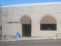
For several decades, Camden was the headquarters of the Clyde E. Palmer newspaper chain, which included The Camden News, the Texarkana Gazette, the Hot Springs Sentinel-Record, and the Magnolia Banner News. The daily newspaper in Camden is the original flagship publication of WEHCO Media.
Near the end of World War II, thousands of new jobs were created with the 1944 construction of a naval ammunition depot across the Ouachita at Shumaker, Arkansas. The Korean War generated new jobs and activity at the depot, which closed after war's end. The city and county redeveloped its facilities and grounds into an extensive industrial area. This was the site of some major defense establishments and multiple smaller industries. A technical campus of Southern Arkansas University is also located there.
In the 1990s, post Cold-War downsizing of the defense industry brought severe job losses—and resulting population decline—to the Camden area. The International Paper Company mill closed a few years later, resulting in more job losses. In recent years, however, a partial resurgence of defense contracts and the development of a diversified mixture of small business and professional activity have stabilized the town's economy.
As one of Arkansas' most historic towns, the city attracts considerable heritage tourism. Camden is home to two major events: the Daffodil Festival in the spring and the BPW Barn Sale in the fall.
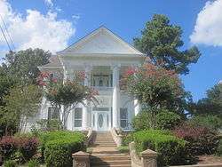
Among the many historic homes in Camden is the Richie-Crawford House at 330 Clifton Street, built in 1909 and featuring four Corinthian columns and a two-story porch. On March 2, 1957, the Camden attorney Maud Robinson Crawford (born 1891) disappeared from the house that she shared with her husband, Clyde Falwell Crawford (1894–1969). Her disappearance remains officially unsolved.[7]
Geography
Camden is located on the Ouachita River, at the end of the navigable part of the river.
According to the United States Census Bureau, the city has a total area of 16.5 square miles (43 km2), of which 16.5 square miles (43 km2) is land and 0.1 square miles (0.26 km2) (0.36%) is water.
Climate
The climate in this area is characterized by hot, humid summers and generally mild to cool winters. According to the Köppen Climate Classification system, Camden has a humid subtropical climate, abbreviated "Cfa" on climate maps.[8]
Demographics
| Historical population | |||
|---|---|---|---|
| Census | Pop. | %± | |
| 1850 | 894 | — | |
| 1860 | 2,219 | 148.2% | |
| 1870 | 1,612 | −27.4% | |
| 1880 | 1,503 | −6.8% | |
| 1890 | 2,571 | 71.1% | |
| 1900 | 2,840 | 10.5% | |
| 1910 | 3,995 | 40.7% | |
| 1920 | 3,238 | −18.9% | |
| 1930 | 7,273 | 124.6% | |
| 1940 | 8,975 | 23.4% | |
| 1950 | 11,372 | 26.7% | |
| 1960 | 15,823 | 39.1% | |
| 1970 | 15,147 | −4.3% | |
| 1980 | 15,356 | 1.4% | |
| 1990 | 14,380 | −6.4% | |
| 2000 | 13,154 | −8.5% | |
| 2010 | 12,183 | −7.4% | |
| Est. 2017 | 11,030 | [2] | −9.5% |
| U.S. Decennial Census[9] 2014 Estimate[10] | |||
As of the 2010 United States Census, there were 12,183 people residing in the city. The racial makeup of the city was 55.9% Black, 40.0% White, 0.3% Native American, 0.5% Asian, <0.1% Pacific Islander, 0.1% from some other race and 1.6% from two or more races. 1.6% were Hispanic or Latino of any race.
As of the census[11] of 2000, there were 13,154 people, 5,421 households, and 3,561 families residing in the city. The population density was 799.4 people per square mile (308.7/km²). There were 6,259 housing units at an average density of 380.4 per square mile (146.9/km²). The racial makeup of the city was 48.88% Black or African American, 49.41% White, 0.37% Asian, 0.24% Native American, 0.02% Pacific Islander, 0.20% from other races, and 0.87% from two or more races. 0.58% of the population were Hispanic or Latino of any race.
There were 5,421 households out of which 30.0% had children under the age of 18 living with them, 42.6% were married couples living together, 19.4% had a female householder with no husband present, and 34.3% were non-families. 31.5% of all households were made up of individuals and 16.0% had someone living alone who was 65 years of age or older. The average household size was 2.36 and the average family size was 2.97.
In the city, the population was spread out with 26.2% under the age of 18, 8.1% from 18 to 24, 24.6% from 25 to 44, 21.7% from 45 to 64, and 19.4% who were 65 years of age or older. The median age was 39 years. For every 100 females, there were 82.0 males. For every 100 females age 18 and over, there were 76.4 males.
The median income for a household in the city was $27,814, and the median income for a family was $35,291. Males had a median income of $31,257 versus $19,046 for females. The per capita income for the city was $14,599. About 18.5% of families and 22.5% of the population were below the poverty line, including 32.0% of those under age 18 and 19.4% of those age 65 or over.
Education
Camden was once served by Camden School District and Fairview School District. In 1990 the two districts merged. Public education for early childhood, elementary and secondary education is available from the following school districts:
- Camden Fairview School District, including Camden Fairview High School.
- Harmony Grove School District, including Harmony Grove High School.
- Hampton School District, including Hampton High School.
Notable people
- Shawn Andrews, professional football player.
- Stacy Andrews, professional football player.
- Jonathan Davis, professional baseball player
- George Washington Hays, Governor of Arkansas (1913–1917).[12]
- Walter E. Hussman, Sr., newspaper publisher.
- Benjamin Travis Laney, mayor of Camden and 33rd governor of Arkansas.
- Ne-Yo, R&B singer, songwriter, producer.
- Andre Patterson, American football coach (NFL).
- David Hampton Pryor, U.S. Senator (1979–1997) and Governor of Arkansas (1975–1979).
- Tony Tillman, hip hop artist, songwriter.
- Tommy Tuberville, college football coach (1980–present).
- Gertrude Weaver, at one point the oldest living person in the world
- Corey Williams, professional football player.
- Gary Wilson, baseball player who briefly played for the Houston Astros
See also
References
- ↑ "2017 U.S. Gazetteer Files". United States Census Bureau. Retrieved Aug 22, 2018.
- 1 2 "Population and Housing Unit Estimates". Retrieved March 24, 2018.
- ↑ "Population of the City of Camden, Arkansas". censusviewer.com. Retrieved August 9, 2012.
- ↑ Williams, E. Russ (1982). Filhiol and the Founding of the Spanish Poste d'Ouachita. Monroe, LA: Monroe-Ouachita Valley Bicentennial Commission.
- ↑ Dillard, Tom (20 December 2015). "Chidester Stage Lines". Arkansas Democrat-Gazette.
- ↑ Bearss, Edwin C. (1967). Steele's Retreat from Camden and the Battle of Jenkins' Ferry. Arkansas Civil War Centennial Commission.
- ↑ "The Riche-Crawford House". ltc4940.blogspot.com. Retrieved January 14, 2011.
- ↑ Climate Summary for Camden, Arkansas
- ↑ "Census of Population and Housing". Census.gov. Archived from the original on May 12, 2015. Retrieved June 4, 2015.
- ↑ "Annual Estimates of the Resident Population for Incorporated Places: April 1, 2010 to July 1, 2014". Retrieved June 4, 2015.
- ↑ "American FactFinder". United States Census Bureau. Archived from the original on September 11, 2013. Retrieved 2008-01-31.
- ↑ "Arkansas Governor George Washington Hays". National Governors Association. Retrieved August 20, 2012.
External links
Municipalities and communities of Ouachita County, Arkansas, United States | ||
|---|---|---|
| Cities | 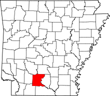 | |
| Town | ||
| CDP | ||
| Unincorporated communities | ||