California State Route 22
| ||||
|---|---|---|---|---|
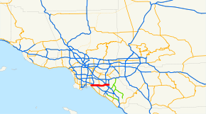 SR 22 highlighted in red | ||||
| Route information | ||||
| Defined by Streets and Highways Code § 322 | ||||
| Maintained by Caltrans | ||||
| Length |
14.725 mi[1] (23.698 km) SR 22's length is broken into pieces and therefore does not reflect the overlaps that would be required to make the route continuous. | |||
| Existed | 1934 – present | |||
| Major junctions | ||||
| West end |
| |||
| ||||
| East end |
| |||
| Location | ||||
| Counties | Los Angeles, Orange | |||
| Highway system | ||||
| ||||

State Route 22 (SR 22) in the U.S. state of California is an east–west highway in southern Los Angeles County and northern Orange County. It runs between Long Beach and Orange by way of Garden Grove. The westernmost part of it is a surface street, Long Beach's 7th Street. From West Garden Grove to its eastern terminus in Orange, it is known as the Garden Grove Freeway. It is one of the two principal east–west routes in Orange County (the other being SR 91 approximately eight miles (13 km) to the north).
Route description
SR 22 begins at the intersection of 7th Street and Pacific Coast Highway (State Route 1) in Long Beach. Then, 7th Street widens from an expressway into a freeway just before crossing the San Gabriel River (and with it, the Los Angeles/Orange County line). It then merges with the San Diego Freeway (Interstate 405) at the Interstate 605 interchange and runs concurrently with it for approximately three miles before the two routes diverge in northeastern Seal Beach. Thereafter, the Garden Grove Freeway travels mostly within the city of Garden Grove or along its border with neighboring Westminster. Just inside the Orange city limits, the freeway enters the infamously congested Orange Crush interchange with the Santa Ana and Orange Freeways (Interstate 5 and State Route 57, respectively). It continues along the border of Orange and Santa Ana for 3 miles (4.8 km) until terminating at the Costa Mesa Freeway (State Route 55).
SR 22 is part of the California Freeway and Expressway System,[2] and is part of the National Highway System,[3] a network of highways that are considered essential to the country's economy, defense, and mobility by the Federal Highway Administration.[4] SR 22 from I-405 to SR 55 is known as the Garden Grove Freeway, as named by the State Highway Commission on October 22, 1957.[5] An 8-mile (13 km) stretch of Route 22 is named the Garden Grove Police Officers Memorial Highway to honor police officers killed in the line of duty.[6]
History
SR 22 was originally designated in 1934, when the state highway system was first numbered. Before the freeway was built, it was routed along Garden Grove Boulevard (formerly Ocean Avenue).[7]
Opened in 1967, the Garden Grove Freeway had the distinction of being one of the few freeways in Southern California to have never been widened from its original alignment, eventually resulting in severe rush hour congestion, particularly as Santa Ana's population surged to over 300,000 during the 1990s.
In late 2004, in response to California's budgetary deficit, OCTA began a widening project to add one mixed-flow and one high occupancy vehicle lane to the route in each direction, as well as reconfiguring and upgrading on and off ramps to contemporary standards at several interchanges, all funded by Measure M, the half-cent tax of Orange County, CA. This $700 million Design-Build projected completed in a record 2 year time frame in 2007 was led by consortium composed of Granite Construction and URS Corp. as the lead designer along with several sub-consultants. A second phase to add HOV lane interchanges at the I-605 junction and at the split with I-405 was recently completed.
Major intersections
Except where prefixed with a letter, postmiles were measured on the road as it was in 1964, based on the alignment that existed at the time, and do not necessarily reflect current mileage. R reflects a realignment in the route since then, M indicates a second realignment, L refers an overlap due to a correction or change, and T indicates postmiles classified as temporary (for a full list of prefixes, see the list of postmile definitions).[1] Segments that remain unconstructed or have been relinquished to local control may be omitted. The numbers reset at county lines; the start and end postmiles in each county are given in the county column.
| County | Location | Postmile [1][8][9] | Exit [10] | Destinations | Notes |
|---|---|---|---|---|---|
| Los Angeles LA 0.00-1.47 | Long Beach | 0.00 | West end of SR 22; no left turn to SR 1 south; 7th Street continues beyond SR 1 | ||
| 0.08 | |||||
| West end of freeway | |||||
| 1.14 | 1 | Studebaker Road | |||
| Orange ORA 0.00-R13.16 | Seal Beach | R0.37- R0.65 23.28[N 1] | 2 | West end of I-405 overlap; no exit number westbound; former SR 7; I-405 exits 23A-B; I-605 exits 1A-B southbound | |
| 22.64[N 1] | 22[N 2] | Seal Beach Boulevard, Los Alamitos Boulevard | |||
| Seal Beach–Westminster line | 20.75[N 1] R0.66 | — | East end of I-405 overlap; eastbound exit and westbound entrance | ||
| Garden Grove | R0.92 | 5 | Eastbound signage omits Bolsa Chica Rd, westbound signage omits Garden Grove Blvd | ||
| R2.65 | 7 | Knott Street, Golden West Street - Westminster | |||
| Garden Grove–Westminster line | R3.59 | 8 | |||
| Garden Grove | R4.81 | 9 | Magnolia Street | ||
| R5.82 | 10 | Brookhurst Street – Garden Grove | |||
| R6.81 | 11 | Euclid Street | |||
| R7.83 | 12 | Harbor Boulevard | Signed as exits 12A (south) and 12B (north) eastbound | ||
| R8.82 | 13 | Fairview Street, Haster Street | Fairview Street eastbound/Haster Street westbound | ||
| Orange | R9.73 | 14A | The City Drive | ||
| Santa Ana | R10.01 | 14B | Bristol Street | No westbound exit | |
| Orange–Santa Ana line | R10.48 | 14C | Eastbound exit and westbound entrance; I-5 exit 106 northbound, 107A-B southbound | ||
| R10.48 | 14D | Signed as exit 14B westbound; provides direct exit ramp onto Chapman Ave; I-5 exit 107A northbound, CA 57 exits 1A-B southbound | |||
| Orange | R10.99 | 15 | Main Street | ||
| R11.83 | 16 | Glassell Street, Grand Avenue | |||
| R12.87 | 17A | Tustin Avenue | Eastbound exit and westbound entrance | ||
| R13.16 | 17B-C | East end of SR 22; signed as exits 17B (south) and 17C (north); SR 55 exit 13 | |||
1.000 mi = 1.609 km; 1.000 km = 0.621 mi
| |||||
See also


References
- 1 2 3 California Department of Transportation. "State Truck Route List". Sacramento: California Department of Transportation. Archived from the original (XLS file) on June 30, 2015. Retrieved June 30, 2015.
- ↑ California State Legislature. "Section 250–257". Streets and Highways Code. Sacramento: California State Legislature. Retrieved June 9, 2017.
- ↑ Federal Highway Administration (March 25, 2015). National Highway System: Los Angeles, CA (PDF) (Map). Scale not given. Washington, DC: Federal Highway Administration. Retrieved October 19, 2017.
- ↑ Natzke, Stefan; Neathery, Mike & Adderly, Kevin (June 20, 2012). "What is the National Highway System?". National Highway System. Washington, DC: Federal Highway Administration. Retrieved July 1, 2012.
- ↑ California Department of Transportation; California State Transportation Agency (January 2015). 2014 Named Freeways, Highways, Structures and Other Appurtenances in California. Sacramento: California Department of Transportation. p. 118. Archived from the original (PDF) on May 30, 2015. Retrieved May 30, 2015.
- ↑ Luevano, Amanda (May 14, 2009). "Garden Grove police unveil memorial highway sign". Orange County Register. Retrieved May 15, 2009.
- ↑ California Highways
- ↑ California Department of Transportation (July 2007). "Log of Bridges on State Highways". Sacramento: California Department of Transportation.
- ↑ California Department of Transportation, All Traffic Volumes on CSHS, 2005 and 2006
- ↑ California Department of Transportation, California Numbered Exit Uniform System, State Route 22 Freeway Interchanges, I-405 Northbound and I-405 Southbound, Retrieved on 2009-02-05.
External links
| Wikimedia Commons has media related to California State Route 22. |
Route map: