California State Route 203
| ||||
|---|---|---|---|---|
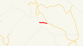 SR 203 highlighted in red | ||||
| Route information | ||||
| Defined by Streets and Highways Code § 503 | ||||
| Maintained by Caltrans | ||||
| Length | 8.67 mi[1] (13.95 km) | |||
| Restrictions | Segment from the Mammoth Mountain Ski Area west to Minaret Summit closed in winter | |||
| Major junctions | ||||
| West end | Minaret Summit | |||
| East end |
| |||
| Location | ||||
| Counties | Mono County, California | |||
| Highway system | ||||
| ||||

State Route 203 is a state highway within Mono County, California, United States. It runs from the Mono-Madera County line (Minaret Summit) to U.S. Route 395 passing through the town of Mammoth Lakes.
Within Mammoth Lakes, State Route 203 is known as both "Minaret Road" and "Main Street." It connects to Lake Mary and the Mammoth Scenic Loop via secondary roads.
Route description
The route begins at Minaret Summit at Devils Postpile National Monument. It then heads east to Mammoth Scenic Loop Road, where it continues at shortly enters the town of Mammoth Lakes, where it is known as both "Minaret Road" and "Main Street". It continues east to its end at U.S. Route 395.
Minaret Summit receives significant snowfall during the winter.[2] The road usually closes near the Main Lodge of Mammoth Mountain Ski Area before Thanksgiving and usually does not open much before Memorial Day.
SR 203 is not part of the National Highway System,[3] a network of highways that are considered essential to the country's economy, defense, and mobility by the Federal Highway Administration.[4]
Major intersections
Except where prefixed with a letter, postmiles were measured on the road as it was in 1964, based on the alignment that existed at the time, and do not necessarily reflect current mileage. R reflects a realignment in the route since then, M indicates a second realignment, L refers an overlap due to a correction or change, and T indicates postmiles classified as temporary (for a full list of prefixes, see the list of postmile definitions).[5] Segments that remain unconstructed or have been relinquished to local control may be omitted. The entire route is in Mono County.
| Location | Postmile [5][1][6] | Destinations | Notes | ||
|---|---|---|---|---|---|
| | L0.00 | Minaret Summit Road – Devils Postpile National Monument | West end of SR 203 | ||
| | R3.80 | ||||
| Mammoth Lakes | 4.78 | Lake Mary Road – Lake Mary | |||
| | R8.67 | Interchange; east end of SR 203 | |||
| 1.000 mi = 1.609 km; 1.000 km = 0.621 mi | |||||
See also

References
- 1 2 California Department of Transportation (April 2008). "Log of Bridges on State Highways". Sacramento: California Department of Transportation.
- ↑ "Subsection M261Eo - Glaciated Batholith". U.S. Forest Service. Archived from the original on 2007-08-13. Retrieved 2007-12-19.
- ↑ Federal Highway Administration (March 25, 2015). National Highway System: California (North) (PDF) (Map). Scale not given. Washington, DC: Federal Highway Administration. Retrieved September 15, 2017.
- ↑ Natzke, Stefan; Neathery, Mike & Adderly, Kevin (June 20, 2012). "What is the National Highway System?". National Highway System. Washington, DC: Federal Highway Administration. Retrieved July 1, 2012.
- 1 2 California Department of Transportation. "State Truck Route List". Sacramento: California Department of Transportation. Archived from the original (XLS file) on June 30, 2015. Retrieved June 30, 2015.
- ↑ California Department of Transportation, All Traffic Volumes on CSHS, 2007
External links
Route map:
| Wikimedia Commons has media related to California State Route 203. |