Calheta, Cape Verde
| Calheta | |
|---|---|
| Settlement | |
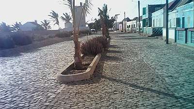 Calheta's main street | |
 Calheta | |
| Coordinates: 15°13′48″N 23°12′43″W / 15.230°N 23.212°WCoordinates: 15°13′48″N 23°12′43″W / 15.230°N 23.212°W | |
| Country | Cape Verde |
| Island | Maio |
| Municipality | Maio |
| Civil parish | Nossa Senhora da Luz |
| Elevation | 6 m (20 ft) |
| Population (2010)[1] | |
| • Total | 1,156 |
Calheta is a town[2] in the western part of the island of Maio. It is situated on the Atlantic coast, around 11 km north of the island capital Porto Inglês and 6 km north of Morro. Its population at the 2010 census was 1,156, making it the island's second most populous settlement. The settlement was mentioned as "Kalyete" in the 1747 map by Jacques-Nicolas Bellin.[3]
See also
References
- ↑ "2010 Census results". Instituto Nacional de Estatística Cabo Verde (in Portuguese). 24 November 2016.
- ↑ Cabo Verde, Statistical Yearbook 2015, Instituto Nacional de Estatística, p. 32-33
- ↑ Jacques-Nicolas Bellin (1747). "Carte des Isles du Cap Verd = Kaart van de Eilanden van Kabo Verde" (in French).
The island of Maio | ||
|---|---|---|
| Communities and settlements | 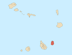 | |
| Mountains | ||
| Other geographical features | ||
This article is issued from
Wikipedia.
The text is licensed under Creative Commons - Attribution - Sharealike.
Additional terms may apply for the media files.