Caledonia, North Dakota
| Caledonia, North Dakota | |
|---|---|
| Census-designated place & unincorporated community | |
 A street in Caledonia | |
 Caledonia, North Dakota Location within the state of North Dakota | |
| Coordinates: 47°27′28″N 096°53′21″W / 47.45778°N 96.88917°WCoordinates: 47°27′28″N 096°53′21″W / 47.45778°N 96.88917°W | |
| Country | United States |
| State | North Dakota |
| County | Traill |
| Area[1] | |
| • Total | 0.519 sq mi (1.34 km2) |
| • Land | 0.519 sq mi (1.34 km2) |
| • Water | 0 sq mi (0 km2) |
| Elevation | 856 ft (261 m) |
| Population (2010)[2] | |
| • Total | 39 |
| Time zone | UTC−6 (Central (CST)) |
| • Summer (DST) | UTC−5 (CDT) |
| ZIP code | 58219 |
| Area code(s) | 701 |
| FIPS code | 38-11500[3] |
| GNIS feature ID | 2584338[3] |
Caledonia is a census-designated place in Traill County, North Dakota in the United States. A former boomtown of the 1870s and the era of the Hudson's Bay Company steamship trade, the community has now all but virtually disappeared.[4]
An unincorporated community, it was designated as part of the U.S. Census Bureau's Participant Statistical Areas Program on March 31, 2010.[5] It was not counted separately during the 2000 Census,[6] but was included in the 2010 Census,[7] where a population of 39 was reported.[2]
History
First called Goose River, the community was established as a post for the Hudson's Bay Company steamships which operated on the Red River of the North.[4] Caledonia became an early boom town in the Red River Valley and also became a post for a stagecoach line which lead north to Fort Garry — now called Winnipeg.[4] Upon the creation of Traill County in 1875, Caledonia was designated as the county seat.[8] However, in that same year, the Hudson's Bay Company closed their U.S. posts including the one at Caledonia. When James J. Hill's railroad crossed Traill County, it bypassed Caledonia. The steamboat industry soon floundered and the county seat was moved to Hillsboro in 1896.[4]
Geography
Caledonia sits on the banks of the Goose River near the confluence with the Red River of the North.[3]
Notes
- ↑ "US Gazetteer files: 2010, 2000, and 1990". United States Census Bureau. 2011-02-12. Retrieved 2011-04-23.
- 1 2 "2010 Census Redistricting Data (Public Law 94-171) Summary File". American FactFinder. United States Census Bureau. Archived from the original on July 21, 2011. Retrieved May 2, 2011.
- 1 2 3 "US Board on Geographic Names". United States Geological Survey. 2007-10-25. Retrieved 2008-01-31.
- 1 2 3 4 "Dakota Datebook — July 10, 2007 — "Frog Point"". Prairie Public Radio. Retrieved 2010-01-30.
- ↑ "Caledonia Census Designated Place". Geographic Names Information System. United States Geological Survey. Retrieved 2010-07-13.
- ↑ U.S. Census Bureau (2003). "Population and Housing Unit Counts, North Dakota" (PDF). 2000 Census of Population and Housing. Government Printing Office. Retrieved 2008-07-20.
- ↑ U.S. Census Bureau (February 13, 2008). "Census Designated Place (CDP) Program for the 2010 Census—Final Criteria" (PDF). Federal Register. Retrieved 2010-07-13.
- ↑ "County History". State of North Dakota. Retrieved 2007-08-06.
| Wikimedia Commons has media related to Caledonia, North Dakota. |
Municipalities and communities of Traill County, North Dakota, United States | ||
|---|---|---|
| Cities | 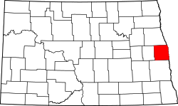 | |
| CDPs | ||
| Unincorporated communities | ||
| Footnotes | ‡This populated place also has portions in an adjacent county or counties | |