Byrranga Mountains
| Byrranga Mountains го́ры Бырра́нга | |
|---|---|
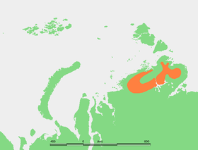 Approximate extent of the Byrranga Mountains in the Taymyr Peninsula. | |
| Highest point | |
| Peak | Lednikovaya Gora |
| Elevation | 1,121 m (3,678 ft) [1] |
| Coordinates | 76°0′N 108°0′E / 76.000°N 108.000°ECoordinates: 76°0′N 108°0′E / 76.000°N 108.000°E |
| Dimensions | |
| Length | 1,100 km (680 mi) ENE/WSW |
| Width | 200 km (120 mi) NNW/SSE |
| Geography | |
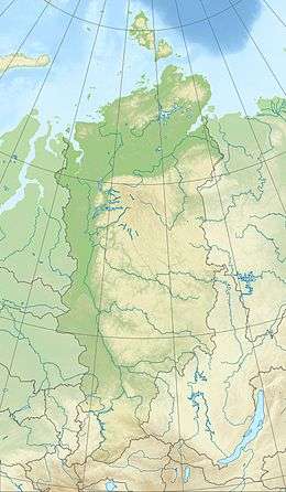 Location in Krasnoyarsk Krai, Russia | |
| Location | Taymyr Peninsula |
| Geology | |
| Type of rock | Siltstones and intrusive rocks |
The Byrranga Mountains (Russian: го́ры Бырра́нга; Gory Byrranga) are a mountain range in the middle of the Taymyr Peninsula, Siberia, Russia.[2]
Even though they were first explored in 1736, the Byrranga Mountains are one of the least known areas of the Arctic. The climate is continental and harsh, with frequent blizzards in the winter.
This mountain range falls into the Krasnoyarsk Krai administrative division of the Russian Federation and is part of the Great Arctic State Nature Reserve, the largest nature reserve in Russia. However, the area is very remote, there is almost no population, and access is very difficult for the lack of roads and settlements.
Geography
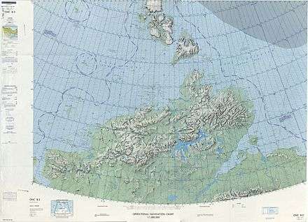
They are located north and west of Lake Taymyr and running for about 1,100 km, forming a looping curve that runs roughly in a southwest to northeast direction. The name is from Nganasan бъранга [bəranga] 'large rocky mountain.'[3]
The range has deep canyons and ravines, as well as a few small glaciers in its eastern zones. These mountains are not very high, being on average about 500 m (1,600 ft). The highest peak is 1,121 m (3,678 ft).[1]
Rivers Khutudabiga and Chetyrekh have their sources in the Byrranga Range. The lower Taymyr River flows northwards cutting across these mountains.[4] The lowlands located to the north and the south of these mountains are covered with tundra, small lakes and wetlands (bogs and marshes).[5]
Geology
The Byrranga range is mainly made up of siltstones and intrusive rocks of neutral composition. There are also vast areas of exposed limestone formation.[6]
See also
References
- 1 2 Leonid M. Baskin: Byrranga Mountains. In: Mark Nuttall (Hrsg.): Encyclopedia of the Arctic. Band 1. Routledge, New York und London 2003, ISBN 1-57958-436-5, S. 298–299
- ↑ "Gory Byrranga". Mapcarta. Retrieved 20 December 2016.
- ↑ Pospelov, E. M. (1998). Geograficheskie nazvaniya mira (in Russian). Moscow. p. 86. ISBN 5892160297.
- ↑ Б. В. Зубовской К истории картографирования центральной части Советской Арктики
- ↑ Biogeography of the Byrranga Mountains, Taymyr Peninsula, Russian Arctic
- ↑ J. Ehlers, P.L. Gibbard, P.D. Hughes eds. Quaternary Glaciations - Extent and Chronology: A Closer Look, p. 373
External links
| Branches |
| ||||||
|---|---|---|---|---|---|---|---|
| Techniques and tools | |||||||
| Institutions |
| ||||||
| Education |
| ||||||
| |||||||