Busby, Montana
| Busby, Montana | |
|---|---|
| CDP | |
 Location of Busby, Montana | |
| Coordinates: 45°32′14″N 106°57′20″W / 45.53722°N 106.95556°WCoordinates: 45°32′14″N 106°57′20″W / 45.53722°N 106.95556°W[1] | |
| Country | United States |
| State | Montana |
| County | Big Horn |
| Area | |
| • Total | 14.2 sq mi (36.9 km2) |
| • Land | 14.2 sq mi (36.8 km2) |
| • Water | 0.0 sq mi (0.1 km2) |
| Elevation[1] | 3,435 ft (1,047 m) |
| Population (2010) | |
| • Total | 745 |
| • Density | 49.0/sq mi (18.9/km2) |
| Time zone | UTC-7 (Mountain (MST)) |
| • Summer (DST) | UTC-6 (MDT) |
| ZIP code | 59016 |
| Area code(s) | 406 |
| FIPS code | 30-11200 |
Busby is a census-designated place (CDP) in Big Horn County, Montana, United States. It is on the Northern Cheyenne reservation. The population was 745 at the 2010 census. The town is about twenty miles northeast of the site of the Battle of the Rosebud and the associated Rosebud Battlefield State Park, where General George Crooks forces encountered Sioux and Cheyenne forces led by Crazy Horse.
The town is named for postmaster Sheridan Busby.[2] The post office was established in 1904.[3]
Trader W. P. Moncure erected the Two Moons Monument at Busby in 1936.[2]
Geography
The community is on Rosebud Creek and US Route 212.[4]
It is on the Northern Cheyenne Indian Reservation.
According to the United States Census Bureau, the CDP has a total area of 14.2 square miles (37 km2), of which, 14.2 square miles (37 km2) of it is land and 0.1 square miles (0.26 km2) of it (0.35%) is water.
Demographics
As of the census[5] of 2000, there were 695 people, 177 households, and 147 families residing in the CDP. The population density was 49.0 people per square mile (18.9/km2). There were 201 housing units at an average density of 14.2 per square mile (5.5/km2). The racial makeup of the CDP was 6.33% White, 89.50% Native American, 0.14% from other races, and 4.03% from two or more races. Hispanic or Latino of any race were 3.31% of the population.
There were 177 households out of which 54.2% had children under the age of 18 living with them, 54.2% were married couples living together, 22.0% had a female householder with no husband present, and 16.4% were non-families. 14.7% of all households were made up of individuals and 5.6% had someone living alone who was 65 years of age or older. The average household size was 3.93 and the average family size was 4.34.
In the CDP, the population was spread out with 46.2% under the age of 18, 7.3% from 18 to 24, 25.5% from 25 to 44, 16.4% from 45 to 64, and 4.6% who were 65 years of age or older. The median age was 21 years. For every 100 females there were 99.1 males. For every 100 females age 18 and over, there were 94.8 males.
The median income for a household in the CDP was $28,750, and the median income for a family was $30,625. Males had a median income of $25,208 versus $25,250 for females. The per capita income for the CDP was $8,383. About 30.2% of families and 35.8% of the population were below the poverty line, including 41.4% of those under age 18 and 32.4% of those age 65 or over.
Climate
According to the Köppen Climate Classification system, Busby has a semi-arid climate, abbreviated "BSk" on climate maps.[6]
| Climate data for Busby, Montana | |||||||||||||
|---|---|---|---|---|---|---|---|---|---|---|---|---|---|
| Month | Jan | Feb | Mar | Apr | May | Jun | Jul | Aug | Sep | Oct | Nov | Dec | Year |
| Average high °C (°F) | 0 (32) |
3 (37) |
8 (46) |
15 (59) |
21 (69) |
26 (78) |
31 (88) |
31 (87) |
24 (76) |
17 (62) |
8 (46) |
2 (35) |
16 (60) |
| Average low °C (°F) | −16 (4) |
−12 (10) |
−7 (19) |
−2 (29) |
3 (38) |
8 (47) |
11 (52) |
9 (49) |
4 (40) |
−1 (30) |
−8 (18) |
−13 (8) |
−2 (29) |
| Average precipitation mm (inches) | 15 (0.6) |
13 (0.5) |
18 (0.7) |
33 (1.3) |
58 (2.3) |
61 (2.4) |
33 (1.3) |
30 (1) |
36 (1.4) |
30 (1.2) |
18 (0.7) |
15 (0.6) |
348 (13.7) |
| Average precipitation days | 8 | 6 | 7 | 8 | 9 | 9 | 6 | 5 | 6 | 6 | 6 | 7 | 83 |
| Source: Weatherbase [7] | |||||||||||||
Notable people
- General George Crook led troops through this area to the Battle of the Rosebud in 1876
References
- 1 2 U.S. Geological Survey Geographic Names Information System: Busby, Montana
- 1 2 "Montana Place Names Companion". Montana Historical Society. Retrieved 29 July 2017.
- ↑ Carkeek Cheney, Roberta (1983). Names on the Face of Montana. Missoula, Montana: Mountain Press Publishing Company. ISBN 0-87842-150-5.
- ↑ Busby, Montana, 7.5 Minute Topographic Quadrangle, USGS, 1958 (1978 rev.)
- ↑ "American FactFinder". United States Census Bureau. Archived from the original on 2013-09-11. Retrieved 2008-01-31.
- ↑ Climate Summary for Busby
- ↑ "Weatherbase.com". Weatherbase. 2013. Retrieved on September 25, 2013.
External links
Municipalities and communities of Big Horn County, Montana, United States | ||
|---|---|---|
| City | 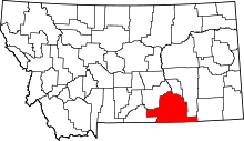 | |
| Town | ||
| CDPs | ||
| Unincorporated communities | ||
| Indian reservations | ||
| Footnotes | ‡This populated place also has portions in an adjacent county or counties | |