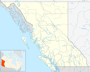
Burquitlam, British Columbia

Burquitlam is a neighbourhood and commercial district of the City of Coquitlam, British Columbia, Canada.
Its name derives from a combination of the names of the cities (then district municipalities) of Burnaby and Coquitlam in order to name a post office for this area, which is just east of the boundary of the two cities and is not used by the City of Burnaby. The Planning Department of the City of Coquitlam describes the area as being north of the golf course, east of North Road,and to the south of the boundary of the City of Port Moody. Burquitlam Plaza is a shopping plaza by the intersection of Clarke Road (a northeastern continuation of the North Road arterial) and Como Lake Ave.[1]
Climate
| Climate data for Burquitlam (BURQUITLAM VANCOUVER GOLF COURSE) (Elevation: 122m) 1981−2010 | |||||||||||||
|---|---|---|---|---|---|---|---|---|---|---|---|---|---|
| Month | Jan | Feb | Mar | Apr | May | Jun | Jul | Aug | Sep | Oct | Nov | Dec | Year |
| Record high °C (°F) | 14.5 (58.1) |
17.5 (63.5) |
24.5 (76.1) |
28.0 (82.4) |
32.0 (89.6) |
33.5 (92.3) |
37.0 (98.6) |
35.0 (95) |
31.5 (88.7) |
26.5 (79.7) |
17.0 (62.6) |
14.5 (58.1) |
37.0 (98.6) |
| Average high °C (°F) | 6.3 (43.3) |
8.3 (46.9) |
10.6 (51.1) |
14.3 (57.7) |
17.5 (63.5) |
20.1 (68.2) |
23.5 (74.3) |
23.5 (74.3) |
20.7 (69.3) |
14.1 (57.4) |
8.9 (48) |
6.2 (43.2) |
14.5 (58.1) |
| Daily mean °C (°F) | 3.8 (38.8) |
4.9 (40.8) |
7.0 (44.6) |
10.0 (50) |
12.9 (55.2) |
15.7 (60.3) |
18.5 (65.3) |
18.6 (65.5) |
17.0 (62.6) |
10.8 (51.4) |
6.4 (43.5) |
3.9 (39) |
10.7 (51.3) |
| Average low °C (°F) | 1.4 (34.5) |
1.6 (34.9) |
3.4 (38.1) |
5.7 (42.3) |
8.3 (46.9) |
11.2 (52.2) |
13.4 (56.1) |
13.5 (56.3) |
11.3 (52.3) |
7.4 (45.3) |
3.8 (38.8) |
1.6 (34.9) |
6.9 (44.4) |
| Record low °C (°F) | −12.0 (10.4) |
−13.5 (7.7) |
−6.5 (20.3) |
0.0 (32) |
1.0 (33.8) |
6.0 (42.8) |
7.0 (44.6) |
9.0 (48.2) |
5.0 (41) |
−4.0 (24.8) |
−10.0 (14) |
−15.5 (4.1) |
−15.5 (4.1) |
| Average precipitation mm (inches) | 286.0 (11.26) |
149.7 (5.894) |
176.3 (6.941) |
137.0 (5.394) |
117.1 (4.61) |
94.7 (3.728) |
61.7 (2.429) |
72.4 (2.85) |
78.3 (3.083) |
206.9 (8.146) |
306.7 (12.075) |
250.3 (9.854) |
1,937 (76.26) |
| Average rainfall mm (inches) | 254.5 (10.02) |
140.9 (5.547) |
171.3 (6.744) |
137.0 (5.394) |
117.1 (4.61) |
94.7 (3.728) |
61.7 (2.429) |
72.4 (2.85) |
78.3 (3.083) |
206.9 (8.146) |
303.6 (11.953) |
234.5 (9.232) |
1,872.7 (73.728) |
| Average snowfall cm (inches) | 31.6 (12.44) |
8.8 (3.46) |
5.1 (2.01) |
0.0 (0) |
0.0 (0) |
0.0 (0) |
0.0 (0) |
0.0 (0) |
0.0 (0) |
0.1 (0.04) |
3.2 (1.26) |
15.8 (6.22) |
64.4 (25.35) |
| Average precipitation days (≥ 0.2 mm) | 19.8 | 14.2 | 19.1 | 15.2 | 13.9 | 12.7 | 7.7 | 6.8 | 7.7 | 16.9 | 21.1 | 19.4 | 174.3 |
| Average rainy days (≥ 0.2 mm) | 18.1 | 13.4 | 18.5 | 15.2 | 13.9 | 12.7 | 7.7 | 6.8 | 7.7 | 16.9 | 20.7 | 17.9 | 169.5 |
| Average snowy days (≥ 0.2 cm) | 3.5 | 1.7 | 1.1 | 0.0 | 0.0 | 0.0 | 0.0 | 0.0 | 0.0 | 0.06 | 1.1 | 2.7 | 10.16 |
| Source: Environment Canada (normals, 1981−2010)[2] | |||||||||||||
Transportation
On December 2, 2016, the SkyTrain's Millennium Line Evergreen Extension opened. The area is served by Burquitlam station.[3]
References
- ↑ BC Names/GeoBC entry "Burquitlam (community)"
- ↑ "BURQUITLAM VANCOUVER GOLF COURSE". Canadian Climate Normals 1981−2010. Retrieved 2018-03-27.
- ↑ Saltman, Jennifer (December 1, 2016). "Trains begin running Friday on SkyTrain's Evergreen extension". 24 Hrs. Retrieved 3 December 2016.
Coordinates: 49°16′00″N 122°53′00″W / 49.26667°N 122.88333°W