Burkardroth
| Burkardroth | ||
|---|---|---|
| ||
 Burkardroth Location of Burkardroth within Bad Kissingen district 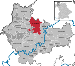 | ||
| Coordinates: 50°16′19″N 9°59′22″E / 50.27194°N 9.98944°ECoordinates: 50°16′19″N 9°59′22″E / 50.27194°N 9.98944°E | ||
| Country | Germany | |
| State | Bavaria | |
| Admin. region | Unterfranken | |
| District | Bad Kissingen | |
| Government | ||
| • Mayor | Waldemar Bug (ÖDP) | |
| Area | ||
| • Total | 69.11 km2 (26.68 sq mi) | |
| Elevation | 304 m (997 ft) | |
| Population (2017-12-31)[1] | ||
| • Total | 7,482 | |
| • Density | 110/km2 (280/sq mi) | |
| Time zone | CET/CEST (UTC+1/+2) | |
| Postal codes | 97705 | |
| Dialling codes | 09734 | |
| Vehicle registration | KG | |
| Website | www.burkardroth.de | |

Burkardroth is a municipality in the district of Bad Kissingen in Bavaria in Germany.
Geography
Burkardroth lies on the south boundary of the biosphere reserve Rhön about 14 km northwest of the district capital of Bad Kissingen. On the north, it borders on the district of Rhön-Grabfeld.
Divisions of the municipality
There are 12 towns in the municipality:
- Burkardroth
- Frauenroth
- Gefäll
- Katzenbach
- Lauter
- Oehrberg
- Premich
- Stangenroth
- Stralsbach
- Waldfenster
- Wollbach
- Zahlbach
History
The present municipality (Markgemeinde) was created in 1972.
Sister cities
- Ense, district of Soest, North Rhine-Westphalia
Sightseeing
The most important architectural monuments are the church of St. Petrus, which dates from the 17th century, and the chapel of the former Cistercian monastery of Frauenroth.
External links
- Official website

References
- ↑ "Fortschreibung des Bevölkerungsstandes". Bayerisches Landesamt für Statistik und Datenverarbeitung (in German). September 2018.
Towns and municipalities in Bad Kissingen | ||
|---|---|---|
| Authority control |
|---|
This article is issued from
Wikipedia.
The text is licensed under Creative Commons - Attribution - Sharealike.
Additional terms may apply for the media files.