Burji special woreda
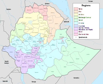
Burji is one of the woredas in the Southern Nations, Nationalities, and Peoples' Region (SNNPR) of Ethiopia. Prior to 2011, Burji was not part of any Zone in the SNNPR and was therefore considered a Special woreda, an administrative subdivision which is similar to an autonomous area. In 2011, the Segen Area Peoples Zone was established, which includes Burji woreda and the 3 former special woredas surrounding it.[1] It is named for the Burji people, who have their homeland in this woreda. Burji is bordered on the east and south by the Oromia Region, on the west by the Konso special woreda, and on the north by the Amaro special woreda. The administrative center of Burji is Soyama.
Burji has 86 kilometers of all-weather roads and 20 kilometers of dry-weather roads, for an average road density of 80 kilometers per 1000 square kilometers.[2]
Demographics
Based on the 2007 Census conducted by the Central Statistical Agency of Ethiopia (CSA), this woreda has a total population of 55,681, of whom 27,207 are men and 28,474 women; with an area of 1,128.40 square kilometers, Burji has a population density of 49.35. While 6,274 or 11.27% are urban inhabitants, a further 12 individuals are pastoralists. A total of 10,619 households were counted in this woreda, which results in an average of 5.24 persons to a household, and 10,266 housing units. The two largest ethnic groups reported in Burji were the Burji (95.53%), and the Konso (1.03%); all other ethnic groups made up 3.44% of the population. Burji was spoken as a first language by 76.31% of the inhabitants, 15.38% spoke Koorete, 5.39% Oromiffa, and 1.07% Konso; the remaining 1.85% spoke all other primary languages reported. 42.8% were Protestants, 35.82% of the population said they were Ethiopian Orthodox Christianity, and 20.93% were Muslim.[3]
In the 1994 Census this woreda had a population of 38,746 in 7,409 households, of whom 19,205 were men and 19,541 women; 4,445 or 11.47% of its population were urban dwellers. The four largest ethnic groups reported in Burji were the Burji (84.54%), the Koorete (11.75%), the Konso (1.3%), and the Amhara (1.06%); all other ethnic groups made up 1.35% of the population. Burji was spoken as a first language by 80.47% of the inhabitants, 13.81% spoke Koorete, 3.9% Oromiffa, 0.87% Konso, and 0.66% spoke Amharic; the remaining 0.29% spoke all other primary languages reported.[4] 42.71% of the population said they were Ethiopian Orthodox Christianity, 24.05% were Protestants, 18.05% practiced traditional religions, and 14.29% were Muslim.[5] Concerning education, 24.19% of the population were considered literate; 14.48% of children aged 7-12 were in primary school; 1.62% of the children aged 13-14 were in junior secondary school, and 1.01% of the inhabitants aged 15-18 were in senior secondary school.[6] Concerning sanitary conditions, about 3% of the urban houses and 9% of all houses had access to safe drinking water at the time of the census; 39% of the urban and 6% of the total had toilet facilities.[7]
Notes
- ↑ MISGANAW ADDIS MOGES (June 2014). "PRACTICE OF SELF-GOVERNMENT IN THE SOUTHERN NATIONS NATIONALITIES AND PEOPLES' REGIONAL STATE: THE CASE OF SEGEN AREA PEOPLES' ZONE" (PDF). ADDIS ABABA: ADDIS ABABA UNIVERSITY COLLEGE OF LAW AND GOVERNANCE – STUDIES CENTRE FOR FEDERAL STUDIES. p. 5.
- ↑ "Detailed statistics on roads" Archived July 20, 2011, at the Wayback Machine., SNNPR Bureau of Finance and Economic Development website (accessed 15 September 2009)
- ↑ Census 2007 Tables: Southern Nations, Nationalities, and Peoples' Region Archived November 13, 2012, at the Wayback Machine., Tables 2.1, 2.4, 2.5, 3.1, 3.2 and 3.4.
- ↑ 1994 Population and Housing Census of Ethiopia: Results for Southern Nations, Nationalities, and Peoples' Region, Vol. 1, part 1 Archived November 19, 2008, at the Wayback Machine., Tables 2.1, 2.12, 2.15 (accessed 30 December 2008)
- ↑ 1994 Population and Housing Census of Ethiopia: Results for Southern Nations, Nationalities, and Peoples' Region, Vol. 2, Table 2.21 (accessed 27 March 2009)
- ↑ 1994 Population and Housing Census of Ethiopia: Results for Southern Nations, Nationalities, and Peoples' Region, Vol. 1, part 2 Archived November 19, 2008, at the Wayback Machine., Tables 3.5, 3.7 (accessed 17 April 2009)
- ↑ 1994 Population and Housing Census of Ethiopia: Results for Southern Nations, Nationalities, and Peoples' Region, Vol. 1, part 2 Archived November 19, 2008, at the Wayback Machine., Tables 6.3, 6.11, 6.13 (accessed 17 April 2009)
Coordinates: 5°30′N 37°50′E / 5.500°N 37.833°E
| Current zones |  | |
|---|---|---|
| Former zones | ||
| Special woredas | ||