Burdine, Kentucky
| Burdine | |
|---|---|
| Unincorporated community | |
 Burdine Location within the state of Kentucky  Burdine Burdine (the US) | |
| Coordinates: 37°11′21″N 82°35′57″W / 37.18917°N 82.59917°WCoordinates: 37°11′21″N 82°35′57″W / 37.18917°N 82.59917°W | |
| Country | United States |
| State | Kentucky |
| County | Letcher |
| Elevation | 1,483 ft (452 m) |
| Time zone | UTC-5 (Eastern (EST)) |
| • Summer (DST) | UTC-4 (EDT) |
| ZIP codes | 41517 |
| GNIS feature ID | 488407[1] |
Burdine is an unincorporated community and coal town in Letcher County, Kentucky, United States. Their post office [2] operated in Burdine from 1907 to 1911.[3]
Climate
The climate in this area is characterized by relatively high temperatures and evenly distributed precipitation throughout the year. The Köppen Climate System describes the weather as humid subtropical, and uses the abbreviation Cfa.[4]
References
- ↑ U.S. Geological Survey Geographic Names Information System: Burdine, Kentucky
- ↑ U.S. Geological Survey Geographic Names Information System: Burdine, Kentucky
- ↑ http://webpmt.usps.gov/pmt007.cfm. Retrieved 2012-07-30. Missing or empty
|title=(help) - ↑ Climate Summary for Burdine, Kentucky
Municipalities and communities of Letcher County, Kentucky, United States | ||
|---|---|---|
| Cities | 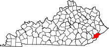 | |
| CDPs | ||
| Unincorporated communities | ||
| Ghost towns | ||
This article is issued from
Wikipedia.
The text is licensed under Creative Commons - Attribution - Sharealike.
Additional terms may apply for the media files.