Bukoba
| Bukoba | |
|---|---|
| town | |
 | |
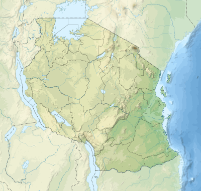 Bukoba Location of Bukoba 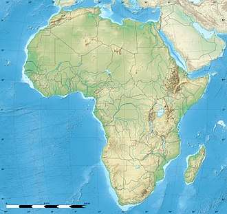 Bukoba Bukoba (Africa)  Bukoba Bukoba (Earth) | |
| Coordinates: 1°20′S 31°49′E / 1.333°S 31.817°E | |
| Country | Tanzania |
| Region | Kagera Region |
| District | Bukoba Urban District |
| Population (2012)[1] | |
| • Urban | 86,022 |
| • Rural | 395,130 |
| Source: National Census Statistical Book – 2003 | |
| Time zone | UTC+3 (East Africa Time) |
| Area code(s) | 028 |
| Climate | Am |
| Website | Regional website |
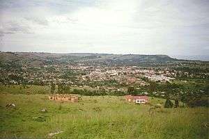
Bukoba is a city situated in the north west of The United Republic of Tanzania on the south western shores of Lake Victoria. It is the capital of the Kagera region, and the administrative seat for Bukoba Urban District. Population estimate: 100,000. The city is served by Bukoba Airport and regular ferry connections to and from Mwanza, as well as roads linking to Uganda's Rakai District for the cross border car commuters with plans underway for a standard gauge railway construction to fulfil the high ambitions of Uganda.
History
Bukoba City
Situated on the south western shores of Lake Victoria, Bukoba lies only 1 degree south of the Equator.
Bukoba city is situated at the South Western shores of Lake Victoria in the north western region of The United Republic Of Tanzania. The regional capital and Kagera's biggest town is the gateway to the region.
Ports
At the moment Bukoba is Tanzania's second largest port on the lake such as Kigoma and Mwanza. [2]
Utility
Bukoba is at the moment is served by the National Electric Utility Company TANESCO.[3]
Climate
The climate is sunny and mild most of the year. It can sometimes get cool especially in the evenings during the two rainy seasons, but never as cold as the winter season in Europe.[4]
Economy
Kagera's Regional Commissioner Col. Fabian Massawe resides and has his head office in The Bukoba Central Business District. [5]
The city is flat and compact, forming a bowl as it is surrounded by hills. The town has a bus stand [6], a big airport [7] and a port [8] with a ferry that used to travel from Bukoba via Kemondo bay port to Mwanza on Monday,Wednesday and Friday nights, but was suspended in 2014 when the ferry broke down irreparably. [9]
Airports
Bukoba Airport
The Airport[10] is located south east of the city. The address on Sokoine Road.
Auric Air[11] flies three times a day to Mwanza. In 2010 the airport[12] was being extended as more flights were expected in line with capacity growth milestones of The Air Terminal reviewed after published reports every quarter of the year.[13]
Transport
Bus
Bus Station[14] leaves for Kampala at 7 am every day (about 6 hours)and from Kampala for Bukoba at 11 am every day. It boasts a white sandy beach, a large market [15], a port [16] tennis courts [17] and a swimming pool[18].It has 3 banks [19], two of which take VISA cards in the ATM.
Bukoba Town itself has the status of a municipal Council. It has a municipal Director and other local government officials like other district councils in the region.
Sports
Bukoba is represented in the Tanzanian Premier League by football club Kagera Sugar. It is the home to several charities - including SHARE in Africa and Jambo Bukoba. Both are focused on the educational sector.
The Kaitaba Stadium[20] is also found in south east of Bukoba on Jamhuri Road.
Climate
| Climate data for Bukoba | |||||||||||||
|---|---|---|---|---|---|---|---|---|---|---|---|---|---|
| Month | Jan | Feb | Mar | Apr | May | Jun | Jul | Aug | Sep | Oct | Nov | Dec | Year |
| Record high °C (°F) | 30.6 (87.1) |
31.0 (87.8) |
31.4 (88.5) |
31.1 (88) |
30.1 (86.2) |
31.1 (88) |
30.6 (87.1) |
28.9 (84) |
30.0 (86) |
29.6 (85.3) |
30.2 (86.4) |
30.3 (86.5) |
31.4 (88.5) |
| Average high °C (°F) | 26.5 (79.7) |
26.6 (79.9) |
26.2 (79.2) |
25.8 (78.4) |
25.6 (78.1) |
25.7 (78.3) |
25.4 (77.7) |
25.5 (77.9) |
25.9 (78.6) |
26.5 (79.7) |
26.2 (79.2) |
26.3 (79.3) |
26.0 (78.8) |
| Daily mean °C (°F) | 21.3 (70.3) |
21.4 (70.5) |
21.3 (70.3) |
21.3 (70.3) |
21.2 (70.2) |
20.8 (69.4) |
20.3 (68.5) |
20.4 (68.7) |
20.8 (69.4) |
21.3 (70.3) |
20.9 (69.6) |
20.6 (69.1) |
20.9 (69.6) |
| Average low °C (°F) | 16.1 (61) |
16.2 (61.2) |
16.3 (61.3) |
16.8 (62.2) |
16.7 (62.1) |
15.9 (60.6) |
15.2 (59.4) |
15.5 (59.9) |
15.7 (60.3) |
16.2 (61.2) |
15.5 (59.9) |
15.0 (59) |
15.9 (60.6) |
| Record low °C (°F) | 11.1 (52) |
11.7 (53.1) |
10.6 (51.1) |
10.6 (51.1) |
10.0 (50) |
12.2 (54) |
10.6 (51.1) |
10.0 (50) |
10.9 (51.6) |
10.6 (51.1) |
11.1 (52) |
12.8 (55) |
10.0 (50) |
| Average precipitation mm (inches) | 154 (6.06) |
173 (6.81) |
253 (9.96) |
367 (14.45) |
304 (11.97) |
84 (3.31) |
51 (2.01) |
71 (2.8) |
98 (3.86) |
170 (6.69) |
209 (8.23) |
208 (8.19) |
2,144 (84.41) |
| Average precipitation days (≥ 1.0 mm) | 13 | 13 | 18 | 20 | 17 | 6 | 5 | 8 | 10 | 15 | 18 | 16 | 158 |
| Average relative humidity (%) | 79 | 79 | 79 | 80 | 80 | 77 | 75 | 78 | 78 | 77 | 79 | 78 | 78 |
| Source: Deutscher Wetterdienst[21] | |||||||||||||
Gallery
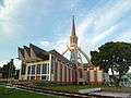 The Mater Misericordiae Church.
External links
| Wikimedia Commons has media related to Bukoba. |
| Wikivoyage has a travel guide for Bukoba. |
References
- ↑ "Population". National Census Statistical Book – 200. kagera.org.
- ↑ http://www.ports.go.tz
- ↑ http://www.tanesco.co.tz
- ↑ http://www.weather.com
- ↑ http://www.mit.go.tz
- ↑ http://www.mwtc.go.tz
- ↑ http://www.taa.go.tz
- ↑ http://www.ports.go.t
- ↑ http://www.mwtc.go.tz
- ↑ http://www.taa.go.tz
- ↑ http://www.auricair.com
- ↑ http://www.taa.go.tz
- ↑ http://www.mwtc.go.tz
- ↑ http://www.sumatra.go.tz
- ↑ http://www.mit.go.tz
- ↑ http://www.ports.go.tz
- ↑ http://www.habari.go.tz
- ↑ http://www.habari.go.tz
- ↑ http://www.bot.go.tz
- ↑ http://www.bukobasports.com/
- ↑ "Klimatafel von Bukoba / Tansania" (PDF). Baseline climate means (1961-1990) from stations all over the world (in German). Deutscher Wetterdienst. Retrieved 22 May 2016.