Buckner, Arkansas
| Buckner, Arkansas | |
|---|---|
| Town | |
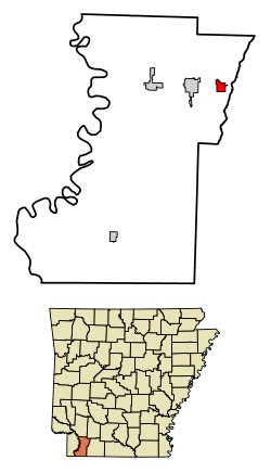 Location of Buckner in Lafayette County, Arkansas. | |
| Coordinates: 33°21′29″N 93°26′12″W / 33.35806°N 93.43667°WCoordinates: 33°21′29″N 93°26′12″W / 33.35806°N 93.43667°W | |
| Country | United States |
| State | Arkansas |
| County | Lafayette |
| Area[1] | |
| • Total | 1.18 sq mi (3.06 km2) |
| • Land | 1.18 sq mi (3.05 km2) |
| • Water | 0.01 sq mi (0.01 km2) |
| Elevation | 292 ft (89 m) |
| Population (2010) | |
| • Total | 275 |
| • Estimate (2017)[2] | 246 |
| • Density | 209.18/sq mi (80.75/km2) |
| Time zone | UTC-6 (Central (CST)) |
| • Summer (DST) | UTC-5 (CDT) |
| ZIP code | 71827 |
| Area code(s) | 870 |
| FIPS code | 05-09550 |
| GNIS feature ID | 0047147 |
Buckner is a town[3] in Lafayette County, Arkansas, United States. The population was 275 at the 2010 census.
Geography
Buckner is located at 33°21′29″N 93°26′12″W / 33.35806°N 93.43667°W (33.358095, -93.436689).[4]
According to the United States Census Bureau, the city has a total area of 1.2 square miles (3.1 km2), all land.
Demographics
| Historical population | |||
|---|---|---|---|
| Census | Pop. | %± | |
| 1890 | 312 | — | |
| 1900 | 400 | 28.2% | |
| 1910 | 240 | −40.0% | |
| 1920 | 360 | 50.0% | |
| 1930 | 264 | −26.7% | |
| 1940 | 450 | 70.5% | |
| 1950 | 335 | −25.6% | |
| 1960 | 289 | −13.7% | |
| 1970 | 392 | 35.6% | |
| 1980 | 436 | 11.2% | |
| 1990 | 325 | −25.5% | |
| 2000 | 396 | 21.8% | |
| 2010 | 275 | −30.6% | |
| Est. 2017 | 246 | [2] | −10.5% |
| U.S. Decennial Census[5] 2014 Estimate[6] | |||
As of the census[7] of 2000, there were 396 people, 144 households, and 112 families residing in the city. The population density was 315.8 people per square mile (122.3/km²). There were 165 housing units at an average density of 131.6/sq mi (51.0/km²). The racial makeup of the city was 52.53% White, 45.20% Black or African American, 0.76% Native American, 0.51% Asian, and 1.01% from two or more races. 0.51% of the population were Hispanic or Latino of any race.
There were 144 households out of which 31.9% had children under the age of 18 living with them, 56.9% were married couples living together, 16.7% had a female householder with no husband present, and 22.2% were non-families. 19.4% of all households were made up of individuals and 6.9% had someone living alone who was 65 years of age or older. The average household size was 2.75 and the average family size was 3.13.
In the city the population was spread out with 25.3% under the age of 18, 9.1% from 18 to 24, 28.5% from 25 to 44, 23.5% from 45 to 64, and 13.6% who were 65 years of age or older. The median age was 38 years. For every 100 females, there were 111.8 males. For every 100 females age 18 and over, there were 96.0 males.
The median income for a household in the city was $24,063, and the median income for a family was $25,179. Males had a median income of $21,875 versus $15,625 for females. The per capita income for the city was $10,192. About 19.1% of families and 25.8% of the population were below the poverty line, including 43.5% of those under age 18 and 21.7% of those age 65 or over.
Climate
The climate in this area is characterized by hot, humid summers and generally mild to cool winters. According to the Köppen Climate Classification system, Buckner has a humid subtropical climate, abbreviated "Cfa" on climate maps.[8]
Infrastructure
References
- ↑ "2017 U.S. Gazetteer Files". United States Census Bureau. Retrieved Aug 22, 2018.
- 1 2 "Population and Housing Unit Estimates". Retrieved March 24, 2018.
- ↑ Local.Arkansas.gov - Buckner, retrieved September 3, 2012
- ↑ "US Gazetteer files: 2010, 2000, and 1990". United States Census Bureau. 2011-02-12. Retrieved 2011-04-23.
- ↑ "Census of Population and Housing". Census.gov. Archived from the original on May 12, 2015. Retrieved June 4, 2015.
- ↑ "Annual Estimates of the Resident Population for Incorporated Places: April 1, 2010 to July 1, 2014". Retrieved June 4, 2015.
- ↑ "American FactFinder". United States Census Bureau. Archived from the original on 2013-09-11. Retrieved 2008-01-31.
- ↑ Climate Summary for Buckner, Arkansas
External links
Municipalities and communities of Lafayette County, Arkansas, United States | ||
|---|---|---|
| Cities | 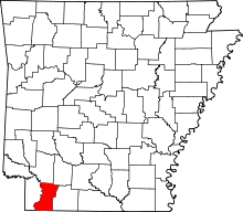 | |
| Town | ||
| Unincorporated communities | ||