Buckland Newton
| Buckland Newton | |
|---|---|
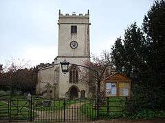 The Church of the Holy Rood, Buckland Newton | |
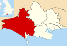
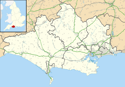 Buckland Newton Buckland Newton shown within Dorset | |
| Area | 9.4 sq mi (24 km2) |
| Population | 622 [1] |
| • Density | 66/sq mi (25/km2) |
| OS grid reference | ST692053 |
| District | |
| Shire county | |
| Region | |
| Country | England |
| Sovereign state | United Kingdom |
| Police | Dorset |
| Fire | Dorset and Wiltshire |
| Ambulance | South Western |
| EU Parliament | South West England |
| UK Parliament |
|
Buckland Newton is a village and civil parish in Dorset, England. It is situated in the West Dorset administrative district beneath the scarp slope of the Dorset Downs, 7 1⁄2 miles (12.1 km) south of Sherborne.[2] In the 2011 census the civil parish had a population of 622.[1] The village covers around 6000 acres.[3]
The village lies within the Buckland Newton Hundred. Amenities in the village include a shop, primary school and village hall.[4]
History
The name 'Buckland' derives from bōc-land, Old English for 'charter land' or land with special privileges created by royal diploma, while 'Newton' is a more recent addition taken from Sturminster Newton, a nearby town.[5]
The parish originally had five settlements, each with their own open field system: Buckland Newton, Brockhampton, Duntish, Henley (perhaps previously known as Knoll) and Minterne Parva, the last now part of Minterne Magna parish.[3]
Although the Parish Church of the Holy Rood was restored in the 19th century, it has a 13th-century chancel and 15th-century nave, west tower and aisles, plus fragments of 12th-century sculpture which are evidence of an earlier structure.[3] In 1980 the writer and literary director Roland Gant described Holy Rood as "a lovely church", but that the first impression it created was not favourable due to its exterior having been rendered in cement, "giving the Perpendicular square tower the look of a Foregn Legion fort".[6]
Duntish Court, sited about 1⁄2 mile (0.80 km) north of the main village, was a compact, classical country house built in 1764 beside the main Weymouth to Bath turnpike road. Designed by Sir William Chambers, the Court—originally named Castle Hill—had notable plasterwork, grounds of 1,300 acres (530 ha) and played a role in the arrest of agricultural labourers in Dorset's 'Captain Swing' riots of 1830. It was demolished in 1965.[7]
Geography
Prominent nearby hills at the top of the escarpment to the southeast include the 820 ft (250 m) Ball Hill and the 860 ft (260 m) Lyscombe Hill near the Dorsetshire Gap.[8] The southern part of the parish is mainly chalk with an elevation ranging from 500–800 feet (150–240 m). The northern lies between 300–500 feet (90–150 m) above sea-level and is mainly clay with Gault and Corallian Limestone beds.[3]
References
- 1 2 "Neighbourhood Statistics. Area: Buckland Newton (Parish). Key Figures for 2011 Census: Key Statistics". Office for National Statistics. Retrieved 14 January 2014.
- ↑ Google. "Seagrove Bay" (Map). Google Maps. Google.
- 1 2 3 4 "'Buckland Newton', An Inventory of the Historical Monuments in Dorset, Volume 3: Central (1970), pp. 48-54". British History Online. University of London & History of Parliament Trust. November 2013. Retrieved 5 June 2014.
- ↑ "Around the Village". Buckland Newton Community Website. bucklandnewton.com. Retrieved 9 June 2014.
- ↑ David Mills, ed. (2011). A Dictionary of British Place Names. Oxford University Press. p. 83. Retrieved 6 June 2014.
- ↑ Roland Gant (1980). Dorset Villages. Robert Hale Ltd. p. 72. ISBN 0-7091-8135-3.
- ↑ Jo Draper (May 2008). "'Leave not a rack behind'". Dorset Life Magazine. Retrieved 5 June 2014.
- ↑ Ordnance Survey 1:50,000 Landranger series
External links
| Wikimedia Commons has media related to Buckland Newton. |