Buck Creek Gap
| Buck Creek Gap | |
|---|---|
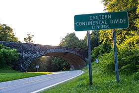 Eastern Continental Divide | |
| Elevation | 3,402 ft (1,037 m)[1] |
| Traversed by |
|
| Location |
|
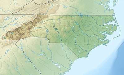
| Range | Blue Ridge Mountains |
| Coordinates | 35°46′15″N 82°09′52″W / 35.7709529°N 82.164562°WCoordinates: 35°46′15″N 82°09′52″W / 35.7709529°N 82.164562°W |
| Topo map | USGS Celo |
Buck Creek Gap (el. 3,402 ft (1,037 m)) is a mountain pass along the Blue Ridge Mountains. NC 80 connects with the Blue Ridge Parkway at the gap, where it travelers can go either towards Burnsville, Marion, Mount Mitchell or Little Switzerland. A scenic overlook is located at the gap, along NC 80; which is sometimes also used as a staging area for motorcycle enthusiasts. The gap is also along the Eastern Continental Divide and the McDowell–Yancey county line.
References
- ↑ "Buck Creek Gap". Geographic Names Information System. United States Geological Survey. Retrieved July 22, 2014.
This article is issued from
Wikipedia.
The text is licensed under Creative Commons - Attribution - Sharealike.
Additional terms may apply for the media files.