Bruno, Minnesota
| Bruno, Minnesota | |
|---|---|
| City | |
 Location of the city of Bruno within Pine County, Minnesota | |
| Coordinates: 46°16′41″N 92°39′51″W / 46.27806°N 92.66417°W | |
| Country | United States |
| State | Minnesota |
| County | Pine |
| Incorporated | August 29, 1903[1] |
| Government | |
| • Mayor | Denny Molgaard[2] |
| Area[3] | |
| • Total | 1.00 sq mi (2.59 km2) |
| • Land | 1.00 sq mi (2.59 km2) |
| • Water | 0 sq mi (0 km2) |
| Elevation | 1,152 ft (351 m) |
| Population (2010)[4] | |
| • Total | 102 |
| • Estimate (2016)[5] | 99 |
| • Density | 100/sq mi (39/km2) |
| • Demonym | Brunoine |
| Time zone | UTC-6 (Central (CST)) |
| • Summer (DST) | UTC-5 (CDT) |
| ZIP code | 55712 |
| Area code(s) | 320 |
| FIPS code | 27-08290[6] |
| GNIS feature ID | 0640554[7] |
Bruno is a city in Pine County, Minnesota, United States. The population was 102 at the 2010 census.[8]
Minnesota State Highway 23 serves as a main route in the community.
Geography
According to the United States Census Bureau, the city has a total area of 1.00 square mile (2.59 km2), all land.[3]
History
Named after Bruno Township, after an early hotel owner there,[9] the city of Bruno was incorporated on August 29, 1903. Before, the Eastern Railway Company of Minnesota operated a station in 1887 known as Mansfield Station, a village owned and platted by Fitzhugh Burns. Post office service began in 1896. Because many of the early settlers were from Czechoslovakia, the city may also have been named for Brno, a village in the Czech Republic.
Community
Bruno is a small town, intersected by Minnesota State Highway 23. The town has three churches, a U.S. Post Office (ZIP code 55712), an auto repair shop, a thrift store, volunteer fire department, and a tavern. The tavern offers limited food and drinks, but has recently added free Wi-Fi wireless internet service, which one isn't likely to find for free between North Branch and Duluth (as of late 2014 the tavern has been destroyed in a fire but in Spring 2015 their plans to rebuild were announced via their Facebook page). There is also a small park for travelers to park and rest with restrooms; and a well for fresh water. Bruno is also home to Nemadji Research Corporation.
Demographics
| Historical population | |||
|---|---|---|---|
| Census | Pop. | %± | |
| 1910 | 229 | — | |
| 1920 | 217 | −5.2% | |
| 1930 | 167 | −23.0% | |
| 1940 | 234 | 40.1% | |
| 1950 | 193 | −17.5% | |
| 1960 | 116 | −39.9% | |
| 1970 | 130 | 12.1% | |
| 1980 | 130 | 0.0% | |
| 1990 | 89 | −31.5% | |
| 2000 | 102 | 14.6% | |
| 2010 | 102 | 0.0% | |
| Est. 2016 | 99 | [5] | −2.9% |
| U.S. Decennial Census[10] | |||
2010 census
As of the census[4] of 2010, there were 102 people, 44 households, and 29 families residing in the city. The population density was 102.0 inhabitants per square mile (39.4/km2). There were 53 housing units at an average density of 53.0 per square mile (20.5/km2). The racial makeup of the city was 92.2% White, 1.0% African American, 4.9% Native American, and 2.0% from two or more races.
There were 44 households of which 22.7% had children under the age of 18 living with them, 50.0% were married couples living together, 9.1% had a female householder with no husband present, 6.8% had a male householder with no wife present, and 34.1% were non-families. 29.5% of all households were made up of individuals and 18.1% had someone living alone who was 65 years of age or older. The average household size was 2.32 and the average family size was 2.86.
The median age in the city was 47 years. 23.5% of residents were under the age of 18; 6.9% were between the ages of 18 and 24; 17.6% were from 25 to 44; 27.3% were from 45 to 64; and 24.5% were 65 years of age or older. The gender makeup of the city was 50.0% male and 50.0% female.
2000 census
As of the census[6] of 2000, there were 102 people, 44 households, and 28 families residing in the city. The population density was 102.0 people per square mile (39.4/km²). There were 56 housing units at an average density of 56.0 per square mile (21.6/km²). The racial makeup of the city was 96.08% White, 0.98% African American and 2.94% Native American.
There were 44 households out of which 22.7% had children under the age of 18 living with them, 50.0% were married couples living together, 15.9% had a female householder with no husband present, and 34.1% were non-families. 27.3% of all households were made up of individuals and 9.1% had someone living alone who was 65 years of age or older. The average household size was 2.32 and the average family size was 2.83.
In the city, the population was spread out with 25.5% under the age of 18, 7.8% from 18 to 24, 22.5% from 25 to 44, 27.5% from 45 to 64, and 16.7% who were 65 years of age or older. The median age was 43 years. For every 100 females, there were 78.9 males. For every 100 females age 18 and over, there were 85.4 males.
The median income for a household in the city was $28,125, and the median income for a family was $33,125. Males had a median income of $31,875 versus $15,000 for females. The per capita income for the city was $15,439. There were 18.5% of families and 19.0% of the population living below the poverty line, including 100.0% of under eighteens and none of those over 64.
References
- ↑ http://www.lakesnwoods.com/Bruno.htm
- ↑ http://www.co.pine.mn.us/index.asp?Type=B_BASIC&SEC=%7B4BE2F27C-B77C-4F0A-9BE6-BFAFD400FEBF%7D
- 1 2 "US Gazetteer files 2010". United States Census Bureau. Archived from the original on 2012-07-14. Retrieved 2012-11-13.
- 1 2 "American FactFinder". United States Census Bureau. Retrieved 2012-11-13.
- 1 2 "Population and Housing Unit Estimates". Retrieved June 9, 2017.
- 1 2 "American FactFinder". United States Census Bureau. Archived from the original on 2013-09-11. Retrieved 2008-01-31.
- ↑ "US Board on Geographic Names". United States Geological Survey. 2007-10-25. Retrieved 2008-01-31.
- ↑ "2010 Census Redistricting Data (Public Law 94-171) Summary File". American FactFinder. U.S. Census Bureau, 2010 Census. Archived from the original on 21 July 2011. Retrieved 23 April 2011.
- ↑ Upham, Warren (1920). Minnesota Geographic Names: Their Origin and Historic Significance. Minnesota Historical Society. p. 411.
- ↑ "Census of Population and Housing". Census.gov. Archived from the original on May 12, 2015. Retrieved June 4, 2015.
Municipalities and communities of Pine County, Minnesota, United States | ||
|---|---|---|
| Cities | 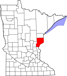 | |
| Townships | ||
| Unincorporated communities | ||
| Ghost towns | ||
| Indian reservation | ||
Coordinates: 46°16′45″N 92°39′52″W / 46.27917°N 92.66444°W