Browning's Beach Historic District
|
Browning's Beach Historic District | |
 | |
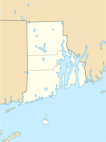  | |
| Location | South Kingstown, Rhode Island |
|---|---|
| Coordinates | 41°22′26″N 71°33′52″W / 41.37389°N 71.56444°WCoordinates: 41°22′26″N 71°33′52″W / 41.37389°N 71.56444°W |
| Area | 20 acres (8.1 ha) |
| Built | 1895 |
| Architectural style | Late 19th And 20th Century Revivals, Queen Anne, Late Victorian |
| NRHP reference # | 97000952 [1] |
| Added to NRHP | September 5, 1997 |
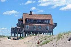
Browning's Beach Historic District is a historic district west of the junction between Card Pond and Matunuck Beach Roads in South Kingstown, Rhode Island. It encompasses a cluster of four beach houses located on a barrier beach facing Long Island Sound south of Cards Pond, and accessed via a private gravel drive extending from Cards Pond Road. The four houses, along with several outbuildings, were built in the early years of the 20th century, and are architecturally diverse expressions of Queen Anne, Shingle, and Colonial Revival elements. Typical architectural elements include shingle siding, recessed porches, and chalet-style roofs.[2]
The district was listed on the National Register of Historic Places in 1997.[1]
See also
References
- 1 2 National Park Service (2007-01-23). "National Register Information System". National Register of Historic Places. National Park Service.
- ↑ "NRHP nomination for Browning's Beach Historic District" (PDF). Rhode Island Preservation. Retrieved 2014-09-25.
| Topics | |
|---|---|
| Lists by states |
|
| Lists by insular areas | |
| Lists by associated states | |
| Other areas | |
| |
This article is issued from
Wikipedia.
The text is licensed under Creative Commons - Attribution - Sharealike.
Additional terms may apply for the media files.