Brown Peak (Sturge Island)
| Brown Peak | |
|---|---|
 Brown Peak | |
| Highest point | |
| Elevation | 1,524 m (5,000 ft) [1] |
| Prominence | 1,524 m (5,000 ft) [1] |
| Listing | Ultra |
| Coordinates | 67°41′S 164°58′E / 67.683°S 164.967°ECoordinates: 67°41′S 164°58′E / 67.683°S 164.967°E [2] |
| Geography | |
| Location | Sturge Island, Balleny Islands, East Antarctica |
| Geology | |
| Mountain type | Stratovolcano |
| Last eruption | Unknown[3] |
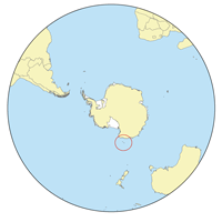
Location of the Balleny Islands
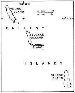
Sturge Island is the southernmost of the Balleny Islands
Brown Peak is a stratovolcano and the highest point of the Balleny Islands. It is situated on the northern part of Sturge Island.
Discovery and naming
John Balleny discovered Brown Peak in February 1839, and named it for W. Brown, a merchant who provided financial support to the Enderby Brothers' expedition. In 1841, Captain James Clark Ross, who sighted the islands on his own expedition to Antarctica, gave it the name Russell Peak.[2]
See also
References
- 1 2 "Brown Peak, Antarctica". Peakbagger.com. Retrieved 2010-03-14.
- 1 2 "Brown Peak". Geographic Names Information System. United States Geological Survey. Retrieved 2010-03-14.
- ↑ "Sturge Island". Global Volcanism Program. Smithsonian Institution. Retrieved 2018-01-21.
Bibliography
- LeMasurier, W. E.; Thomson, J. W., eds. (1990). Volcanoes of the Antarctic Plate and Southern Oceans. American Geophysical Union. pp. 512 pp. ISBN 0-87590-172-7.
External links
- "Brown Peak (New Zealand)". Composite Gazetteer of Antarctica. Scientific Committee on Antarctic Research.
- "Brown Peak (United States)". Composite Gazetteer of Antarctica. Scientific Committee on Antarctic Research.
This article is issued from
Wikipedia.
The text is licensed under Creative Commons - Attribution - Sharealike.
Additional terms may apply for the media files.