Brovari, Buchach Raion
| Brovari Броварі | |
|---|---|
 | |
| Coordinates: 48°57′54″N 25°27′31″E / 48.96500°N 25.45861°ECoordinates: 48°57′54″N 25°27′31″E / 48.96500°N 25.45861°E | |
| Country |
|
| Oblast |
|
| Raion | Buchach Raion |
| Area | |
| • Total | 1.30 km2 (0.50 sq mi) |
| Population (2001 census) | |
| • Total | 362 |
| • Density | 278,46/km2 (72,120/sq mi) |
| Time zone | UTC+2 (EET) |
| • Summer (DST) | UTC+3 (EEST) |
| Postal code | 48467 |
| Area code(s) | +380 3544 |
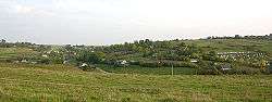
Brovari (Ukrainian: Броварі; Russian: Бровары, translit. Brovary; Polish: Browary; Yiddish: בראָוואַר, translit. Brovar) is a village in the Buchach Raion (district) of the Ternopil Oblast (province) in western Ukraine. Small river Yazlovchyk (left tributary of the river Vil'khovets') flows near of the village.
History
First written mention comes from the early 18th century. Then belonged to the Polish-Lithuanian Commonwealth, from 1772 until 1918 to Austrian (Habsburg Monarchy, Austrian Empire, Austria-Hungary) empires, in 1918-1919 to West Ukrainian People's Republic. From 1991 belonged to Ukraine.
Reading room of Ukrainian society Prosvita operated in the village.
Attractions
- Church of the Blessed Virgin Mary (1904)
- Chapel (reconstruction 1992)
- Statue of the Holy Virgin Mary (near church)
- Memory Cross after the abolition of serfdom
References
Sources
- (in Ukrainian) П. Германович, В. Уніят, Броварі // Ternopil Encyclopedic Dictionary: in 4 v. / editorial board: H. Yavorskyi and other, Ternopil: "Zbruch", 2004, V. 1: А—Й, S. 188. — ISBN 966-528-197-6.
- (in Polish) Browary in the Geographical Dictionary of the Kingdom of Poland, volume I (Aa — Dereneczna) published 1880, S. 383. (in Polish)
.
External links
| Wikimedia Commons has media related to Brovari, Buchach Raion. |
| Cities | ||
|---|---|---|
| Urban-type settlements | ||
| Villages |
| |
This article is issued from
Wikipedia.
The text is licensed under Creative Commons - Attribution - Sharealike.
Additional terms may apply for the media files.