Brohl-Lützing
| Brohl-Lützing | ||
|---|---|---|
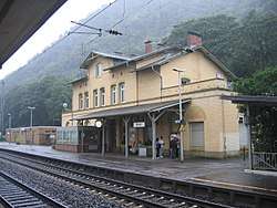 Train station | ||
| ||
 Brohl-Lützing Location of Brohl-Lützing within Ahrweiler district 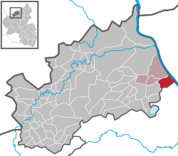 | ||
| Coordinates: 50°29′6″N 7°19′45″E / 50.48500°N 7.32917°ECoordinates: 50°29′6″N 7°19′45″E / 50.48500°N 7.32917°E | ||
| Country | Germany | |
| State | Rhineland-Palatinate | |
| District | Ahrweiler | |
| Municipal assoc. | Bad Breisig | |
| Government | ||
| • Mayor | Christel Ripoll (CDU) | |
| Area | ||
| • Total | 9.23 km2 (3.56 sq mi) | |
| Elevation | 70 m (230 ft) | |
| Population (2017-12-31)[1] | ||
| • Total | 2,492 | |
| • Density | 270/km2 (700/sq mi) | |
| Time zone | CET/CEST (UTC+1/+2) | |
| Postal codes | 56656 | |
| Dialling codes | 02633 (Brohl), 02636 (Niederlützingen) | |

Brohl-Lützing
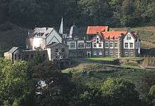
Castle „Augustaburg“
Brohl-Lützing is a municipality in the district of Ahrweiler in Rhineland-Palatinate, Germany.
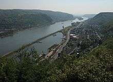
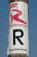 Rheinburgenweg Trail and Rheinhöhenweg Trail
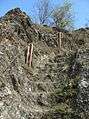 Hiking trail „Eselstreppe“
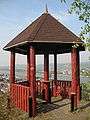 Viewpoint
References
- ↑ Statistisches Landesamt Rheinland-Pfalz "Bevölkerungsstand 2017 - Gemeindeebene" Check
|url=value (help). Statistisches Landesamt Rheinland-Pfalz (in German). 2018.
| Authority control |
|---|
This article is issued from
Wikipedia.
The text is licensed under Creative Commons - Attribution - Sharealike.
Additional terms may apply for the media files.