Bad Breisig (Verbandsgemeinde)
| Bad Breisig | ||
|---|---|---|
| ||
 Bad Breisig Location of Bad Breisig (Verbandsgemeinde) within Landkreis Ahrweiler district 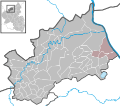  | ||
| Coordinates: 50°30′34″N 7°17′53″E / 50.509351°N 7.298007°ECoordinates: 50°30′34″N 7°17′53″E / 50.509351°N 7.298007°E | ||
| Country | Germany | |
| State | Rhineland-Palatinate | |
| District | Landkreis Ahrweiler | |
| Subdivisions | 4 Gemeinden | |
| Government | ||
| • Mayor | Bernd Weidenbach (CDU) | |
| Area | ||
| • Total | 41.82 km2 (16.15 sq mi) | |
| Population (2017-12-31)[1] | ||
| • Total | 13,368 | |
| • Density | 320/km2 (830/sq mi) | |
| Time zone | CET/CEST (UTC+1/+2) | |
| Vehicle registration | AW | |
| Website | www.bad-breisig.de | |

Bad Breisig is a Verbandsgemeinde ("collective municipality") in the district of Ahrweiler, in Rhineland-Palatinate, Germany. The seat of the municipality is in Bad Breisig.
The Verbandsgemeinde Bad Breisig consists of the following Ortsgemeinden ("local municipalities"):[2]
| Municipality | Area (km²) | Population | |
|---|---|---|---|
| Bad Breisig * | 19.94 | 9,341 | |
| Brohl-Lützing | 9.23 | 2,463 | |
| Gönnersdorf | 5.04 | 622 | |
| Waldorf | 7.61 | 866 | |
| Verbandsgemeinde Bad Breisig | 41.82 | 13,292 |
* seat of the Verbandsgemeinde
References
- ↑ Statistisches Landesamt Rheinland-Pfalz "Bevölkerungsstand 2017 - Gemeindeebene" Check
|url=value (help). Statistisches Landesamt Rheinland-Pfalz (in German). 2018. - ↑ Statistisches Bundesamt – number of inhabitants in the municipalities on 31 December 2016.
| Authority control |
|---|
This article is issued from
Wikipedia.
The text is licensed under Creative Commons - Attribution - Sharealike.
Additional terms may apply for the media files.