Brissarthe
| Brissarthe | |
|---|---|
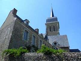 The church in Brissarthe | |
 Brissarthe Location within Pays de la Loire region  Brissarthe | |
| Coordinates: 47°42′06″N 0°26′57″W / 47.7017°N 0.4492°WCoordinates: 47°42′06″N 0°26′57″W / 47.7017°N 0.4492°W | |
| Country | France |
| Region | Pays de la Loire |
| Department | Maine-et-Loire |
| Arrondissement | Segré |
| Canton | Tiercé |
| Area1 | 16.99 km2 (6.56 sq mi) |
| Population (2009)2 | 626 |
| • Density | 37/km2 (95/sq mi) |
| Time zone | UTC+1 (CET) |
| • Summer (DST) | UTC+2 (CEST) |
| INSEE/Postal code | 49051 /49330 |
| Elevation |
17–78 m (56–256 ft) (avg. 23 m or 75 ft) |
|
1 French Land Register data, which excludes lakes, ponds, glaciers > 1 km2 (0.386 sq mi or 247 acres) and river estuaries. 2 Population without double counting: residents of multiple communes (e.g., students and military personnel) only counted once. | |
Brissarthe is a former commune in the Maine-et-Loire department in western France. On 15 December 2016, it was merged into the new commune Les Hauts d'Anjou.[1]
Population
| Historical population | ||
|---|---|---|
| Year | Pop. | ±% |
| 1793 | 1,052 | — |
| 1800 | 974 | −7.4% |
| 1806 | 995 | +2.2% |
| 1821 | 1,006 | +1.1% |
| 1831 | 1,061 | +5.5% |
| 1836 | 1,012 | −4.6% |
| 1841 | 1,020 | +0.8% |
| 1846 | 1,024 | +0.4% |
| 1851 | 1,018 | −0.6% |
| 1856 | 1,035 | +1.7% |
| 1861 | 997 | −3.7% |
| 1866 | 986 | −1.1% |
| 1872 | 904 | −8.3% |
| 1876 | 920 | +1.8% |
| 1881 | 860 | −6.5% |
| 1886 | 840 | −2.3% |
| 1891 | 849 | +1.1% |
| 1896 | 805 | −5.2% |
| 1901 | 762 | −5.3% |
| 1906 | 793 | +4.1% |
| 1911 | 777 | −2.0% |
| 1921 | 638 | −17.9% |
| 1926 | 643 | +0.8% |
| 1931 | 653 | +1.6% |
| 1936 | 619 | −5.2% |
| 1946 | 633 | +2.3% |
| 1954 | 622 | −1.7% |
| 1962 | 645 | +3.7% |
| 1968 | 621 | −3.7% |
| 1975 | 519 | −16.4% |
| 1982 | 514 | −1.0% |
| 1990 | 521 | +1.4% |
| 1999 | 528 | +1.3% |
| 2006 | 599 | +13.4% |
| 2009 | 626 | +4.5% |
See also
References
- ↑ Arrêté préfectoral 28 October 2016 (in French)
| Wikimedia Commons has media related to Brissarthe. |
This article is issued from
Wikipedia.
The text is licensed under Creative Commons - Attribution - Sharealike.
Additional terms may apply for the media files.