Bridgefoot
| Bridgefoot | |
|---|---|
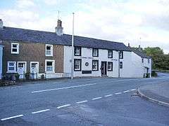 The Dukes Head public house, Bridgefoot, now known as the Duke of Cumberland | |
 Bridgefoot Bridgefoot shown within Cumbria | |
| Population | <500 |
| OS grid reference | NY0529 |
| Civil parish |
|
| District | |
| Shire county | |
| Region | |
| Country | England |
| Sovereign state | United Kingdom |
| Post town | Workington |
| Postcode district | CA14 |
| Dialling code | 01900 |
| Police | Cumbria |
| Fire | Cumbria |
| Ambulance | North West |
| EU Parliament | North West England |
| UK Parliament | |
Bridgefoot is a village in Cumbria, England.[1][2] It is situated at the confluence of the River Marron and Lostrigg Beck, approximately 1 mile south of the River Derwent. To the south it is seamlessly joined with the village of Little Clifton.
References
- ↑ Ordnance Survey: Landranger map sheet 89 West Cumbria (Cockermouth & Wast Water) (Map). Ordnance Survey. 2011. ISBN 9780319232057.
- ↑ "Ordnance Survey: 1:50,000 Scale Gazetteer" (csv (download)). www.ordnancesurvey.co.uk. Ordnance Survey. 1 January 2016. Retrieved 30 January 2016.
| Wikimedia Commons has media related to Bridgefoot. |
This article is issued from
Wikipedia.
The text is licensed under Creative Commons - Attribution - Sharealike.
Additional terms may apply for the media files.