Braeburn Airport
| Braeburn Airport | |||||||||||
|---|---|---|---|---|---|---|---|---|---|---|---|
 | |||||||||||
| Summary | |||||||||||
| Airport type | Public | ||||||||||
| Operator | Government of Yukon | ||||||||||
| Location | Braeburn Lake, Yukon | ||||||||||
| Time zone | PST (UTC−08:00) | ||||||||||
| • Summer (DST) | PDT (UTC−07:00) | ||||||||||
| Elevation AMSL | 2,400 ft / 732 m | ||||||||||
| Coordinates | 61°29′04″N 135°46′35″W / 61.48444°N 135.77639°WCoordinates: 61°29′04″N 135°46′35″W / 61.48444°N 135.77639°W | ||||||||||
| Map | |||||||||||
 CEK2 Location in Yukon | |||||||||||
| Runways | |||||||||||
| |||||||||||
|
Source: Canada Flight Supplement[1] | |||||||||||
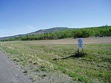
Braeburn Airport, also known as the Cinnamon Bun Airstrip, (TC LID: CEK2) in the Yukon, Canada, is adjacent to the Klondike Highway between Whitehorse and Carmacks. It is next to Braeburn Lodge (famous for its oversized cinnamon buns and sandwiches) and near Braeburn Lake. It receives no maintenance and pilots are advised to use caution as there are numerous holes in the runway caused by gophers.
References
- ↑ Canada Flight Supplement. Effective 0901Z 19 July 2018 to 0901Z 13 September 2018.
External links
- Page about this aerodrome on COPA's Places to Fly airport directory
| By name | |
|---|---|
| By location indicator | |
| By province/territory | |
| By area | |
| National Airports System | |
| Related | |
| |
This article is issued from
Wikipedia.
The text is licensed under Creative Commons - Attribution - Sharealike.
Additional terms may apply for the media files.