Boon Township, Warrick County, Indiana
| Boon Township Warrick County | |
|---|---|
| Township | |
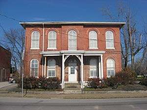 Old Warrick County Jail, a historic place in Boonville | |
 Location in Warrick County | |
| Coordinates: 38°02′23″N 87°16′38″W / 38.03972°N 87.27722°WCoordinates: 38°02′23″N 87°16′38″W / 38.03972°N 87.27722°W | |
| Country | United States |
| State | Indiana |
| County | Warrick |
| Government | |
| • Type | Indiana township |
| Area | |
| • Total | 84.93 sq mi (220.0 km2) |
| • Land | 83.45 sq mi (216.1 km2) |
| • Water | 1.48 sq mi (3.8 km2) 1.74% |
| Elevation | 423 ft (129 m) |
| Population (2010) | |
| • Total | 12,755 |
| • Density | 152.8/sq mi (59.0/km2) |
| ZIP codes | 47601, 47610, 47630 |
| GNIS feature ID | 453124 |
Boon Township is one of ten townships in Warrick County, Indiana, United States. As of the 2010 census, its population was 12,755 and it contained 5,529 housing units.[1]
History
Boon Township was established in 1816 from land given by Anderson Township.[2] It was named for settler Ratliff Boon.[3]
Geography
According to the 2010 census, the township has a total area of 84.93 square miles (220.0 km2), of which 83.45 square miles (216.1 km2) (or 98.26%) is land and 1.48 square miles (3.8 km2) (or 1.74%) is water.[1]
Cities, towns, villages
Unincorporated towns
- Bullocktown at 37°58′29″N 87°13′22″W / 37.974769°N 87.222781°W
- Center at 38°02′55″N 87°20′35″W / 38.048656°N 87.343064°W
- New Hope at 37°59′23″N 87°13′21″W / 37.989769°N 87.222503°W
- Pelzer at 37°59′21″N 87°15′26″W / 37.989213°N 87.257226°W
- Rolling Acres at 38°04′00″N 87°16′15″W / 38.066714°N 87.270839°W
(This list is based on USGS data and may include former settlements.)
Adjacent townships
- Hart Township (north)
- Owen Township (northeast)
- Grass Township, Spencer County (east)
- Skelton Township (east)
- Luce Township, Spencer County (southeast)
- Anderson Township (south)
- Campbell Township (west)
- Ohio Township (west)
Cemeteries
The township contains these cemeteries: Baker, Broshears, Brown Chapel, Clutter Stone, Ellis, Freedom (also known as Mundy Cemetery and Powers Cemetery), Hedge, Maple Grove, Perigo, Plainview Memorial, Small, Thornburg, Warren and Wesley Chapel.
Airports and landing strips
- Boonville Airport
Landmarks
- Scales Lake State Park
School districts
Political districts
- Indiana's 8th congressional district
- State House District 74
- State Senate District 47
References
- "Boon Township, Warrick County, Indiana". Geographic Names Information System. United States Geological Survey. Retrieved 2009-09-24.
- United States Census Bureau 2007 TIGER/Line Shapefiles
- IndianaMap
- 1 2 "Population, Housing Units, Area, and Density: 2010 - County -- County Subdivision and Place -- 2010 Census Summary File 1". United States Census. Retrieved 2013-05-10.
- ↑ Barr, Arvil Sylvester (1915). A History of Warrick County, Indiana, Prior to 1820, Including a Sketch of Methodism in the County Down to 1850. Indiana University. p. 17.
- ↑ Fortune, William (1881). Warrick and Its Prominent People: A History of Warrick County, Indiana from the Time of Its Organization and Settlement. Courier Company. p. 18.