Bongabong, Oriental Mindoro
| Bongabong | ||
|---|---|---|
| Municipality | ||
| Municipality of Bongabong | ||
| ||
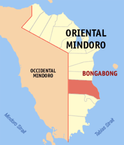 Map of Oriental Mindoro with Bongabong highlighted | ||
.svg.png) Bongabong Location within the Philippines | ||
| Coordinates: 12°43′00″N 121°22′00″E / 12.7167°N 121.3667°ECoordinates: 12°43′00″N 121°22′00″E / 12.7167°N 121.3667°E | ||
| Country |
| |
| Region | Mimaropa (Region IV-B) | |
| Province | Oriental Mindoro | |
| District | 2nd District | |
| Founded | 1927 | |
| Barangays | 36 (see Barangays) | |
| Government [1] | ||
| • Type | Sangguniang Bayan | |
| • Mayor | Elgin Malaluan | |
| • Electorate | 36,800 voters (2016) | |
| Area [2] | ||
| • Total | 498.20 km2 (192.36 sq mi) | |
| Population (2015 census)[3] | ||
| • Total | 72,073 | |
| • Density | 140/km2 (370/sq mi) | |
| Time zone | UTC+8 (PST) | |
| ZIP code | 5211 | |
| PSGC | 175203000 | |
| IDD : area code | +63 (0)43 | |
| Climate type | Tropical climate | |
| Income class | 1st municipal income class | |
| Revenue (₱) | 190,579,545.51 (2016) | |
| Native languages |
Romblomanon Tagalog | |
| Website |
bongabong | |

Bongabong, officially the Municipality of Bongabong, is a 1st class municipality in the province of Oriental Mindoro, Philippines. According to the 2015 census, it has a population of 72,073 people.[3]
Bongabong is 104 kilometres (65 mi) from Calapan, the provincial capital. The town is home to Kuta Bongabong (Fuerza de Bongabong), one of the oldest Spanish colonial fortifications in the Philippines. The fort is in dire need of proper conservation. The only agency with the proper capabilities to restore the fort is the National Museum of the Philippines.[4]
Barangays
Bongabong is politically subdivided into 36 barangays.
| Barangay | Population (2016) |
|---|---|
| Anilao | 2,956 |
| Batangan | 1,279 |
| Bukal | 783 |
| Camantigue | 1,782 |
| Carmundo | 1,649 |
| Cawayan | 2,957 |
| Dayhagan | 1,990 |
| Formon | 1,587 |
| Hagan | 3,397 |
| Hagupit | 672 |
| Kaligtasan | 2,467 |
| Labasan | 4,713 |
| Labonan | 1,562 |
| Libertad | 1,736 |
| Lisap | 6,075 |
| Luna | 1,293 |
| Malitbog | 3,131 |
| Mapang | 825 |
| Masaguisi | 2,257 |
| Morente | 1,833 |
| Ogbot | 1,171 |
| Orconuma | 1,860 |
| Polusahi | 1,011 |
| Sagana | 2,699 |
| San Isidro | 2,082 |
| San Jose | 1,115 |
| San Juan | 467 |
| Santa Cruz | 1,215 |
| Sigange | 1,348 |
| Tawas | 1,485 |
| Poblacion | 1,790 |
| Aplaya | 2,702 |
| Bagumbayan I | 2,323 |
| Bagumbayan II | 1,465 |
| Ipil | 2,589 |
| Mina de Oro | 1,807 |
| Total | 72,073 |
Demographics
| Population census of Bongabong | ||
|---|---|---|
| Year | Pop. | ±% p.a. |
| 1939 | 8,054 | — |
| 1948 | 17,800 | +9.21% |
| 1960 | 22,018 | +1.79% |
| 1970 | 32,167 | +3.86% |
| 1975 | 38,358 | +3.59% |
| 1980 | 41,719 | +1.69% |
| 1990 | 50,213 | +1.87% |
| 1995 | 57,403 | +2.54% |
| 2000 | 59,477 | +0.76% |
| 2007 | 61,127 | +0.38% |
| 2010 | 66,569 | +3.15% |
| 2015 | 72,073 | +1.52% |
| Source: Philippine Statistics Authority[3] [5] [6] [7] | ||
Local government
Elected officials 2013-2016:
- Mayor: Elgin Malaluan
- Vice Mayor: Alfie Montalbo
- Councilors:
- Richard S. Candelario
- OwYe
- Emy I. Enriquez
- Antonio M. Mendeja
- Alvin M. Melendez
- Robert H. Sosa
- Rogelio C. Maulion
- Dado K. A
Festivals
The annual activities in Bongabong are as follows:
- Feast of St. Joseph and Sulyog Festival, March 19
- Bongabong Foundation Day, December 7
Education
Colleges:
- Eastern Mindoro College
- Innovative College Of Science in Information Technology (ICST) - Bongabong, Oriental Mindoro
- Mindoro State College of Agriculture and Technology
High schools:
- Formon National High School
- St. Joseph Academy
- Labasan National High School
- Vicente B. Ylagan National High School
- Masaguisi National High School
- Dayhagan National High School
- Carmundo National High School
- Kaligtasan National High School
- Morente National High School
- Cawayan National High School
Elementary schools:
- Moises Abante Memorial Elementary School
- Formon Elementary School
- Orconuma Elementary School
- Magdalena Umali Suyon Mem. Elem. School
- Sebastian Umali Mem. Elem. School
- Iglicerio Lopez Mem. Elem. School
- Kaligtasan Elementary School
- Cupang Elementary School
- Anilao Elementary School
- Masaguisi Elementary School
- Mina De Oro Elementary School
- Dayhagan Elementary School
- Labonan Elementary School
- Camantigue Elementary School
- Bagong Bayan Central School
- Cawayan Elementary School
- Luna Elementary School
- San Jose Elementary School
- Carmundo Elementary School
- Batangan Elementary School
- Morente Elementary School
References
- ↑ "Municipality". Quezon City, Philippines: Department of the Interior and Local Government. Retrieved 31 May 2013.
- ↑ "Province: Oriental Mindoro". PSGC Interactive. Quezon City, Philippines: Philippine Statistics Authority. Retrieved 12 November 2016.
- 1 2 3 Census of Population (2015). "Region IV-B (Mimaropa)". Total Population by Province, City, Municipality and Barangay. PSA. Retrieved 20 June 2016.
- ↑ http://www.localphilippines.com/attractions/kuta
- ↑ Census of Population and Housing (2010). "Region IV-B (Mimaropa)". Total Population by Province, City, Municipality and Barangay. NSO. Retrieved 29 June 2016.
- ↑ Censuses of Population (1903–2007). "Region IV-B (Mimaropa)". Table 1. Population Enumerated in Various Censuses by Province/Highly Urbanized City: 1903 to 2007. NSO.
- ↑ "Province of Oriental Mindoro". Municipality Population Data. Local Water Utilities Administration Research Division. Retrieved 17 December 2016.
External links
- Oriental Mindoro official Website
- Philippine Standard Geographic Code
- Philippine Census Information
- Local Governance Performance Management System
Places adjacent to Bongabong, Oriental Mindoro | ||||||||||
|---|---|---|---|---|---|---|---|---|---|---|
| ||||||||||
This article is issued from
Wikipedia.
The text is licensed under Creative Commons - Attribution - Sharealike.
Additional terms may apply for the media files.