Bonfim, Roraima
| Bonfim, Roraima | |||
|---|---|---|---|
| Municipality | |||
| The Municipality of Bonfim | |||
 | |||
| |||
 Location of Bonfim in the State of Roraima | |||
 Bonfim, Roraima Location in Brazil | |||
| Coordinates: 03°21′36″N 59°49′58″W / 3.36000°N 59.83278°W | |||
| Country |
| ||
| Region | North | ||
| State |
| ||
| Founded | June 1, 1982 | ||
| Government | |||
| • Mayor | Joner Chagas (PRTB) | ||
| Area | |||
| • Total | 8,095.319 km2 (3,125.620 sq mi) | ||
| Elevation | 92 m (302 ft) | ||
| Population (2010) | |||
| • Total | 10,951 | ||
| • Density | 1.35/km2 (3.5/sq mi) | ||
| Time zone | UTC-4 | ||
| Demonym | bonfinense | ||


Bonfim is a municipality located in the mideast of the state of Roraima in Brazil. Its population is 12,626 and its area is 8,095 km². The city lies opposite the Takutu River from Lethem, Guyana. The Takutu River Bridge links Bonfim and Roraima with the town of Lethem and the Atlantic port of Georgetown, Guyana.[1]
History
Bonfim started with the compound of a religious mission from the US. On July 1, 1982 it became a municipality by Federal Bill Nº 7.009. On March 28, 2007 it was declared a free port for international trade by President Luiz Inácio Lula da Silva.
References
- ↑ Stabroek News at http://gosouthamerica.about.com/b/a/257968.htm%5Bpermanent+dead+link%5D as of 16 March 2007
| Wikimedia Commons has media related to Bonfim, Roraima. |
Capital: Boa Vista | ||
| Boa Vista | 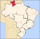 | |
| Nordeste de Roraima | ||
| Caracarai | ||
| Sudeste de Roraima | ||
This article is issued from
Wikipedia.
The text is licensed under Creative Commons - Attribution - Sharealike.
Additional terms may apply for the media files.