Bollion
| Bollion | ||
|---|---|---|
| Former municipality of Switzerland | ||
 | ||
| ||
 Bollion | ||
|
Location of Bollion
Sorry no file found, please edit the map section of the infobox with the correct map image file name. Bollion Bollion (Canton of Fribourg) | ||
| Coordinates: 46°48′N 6°50′E / 46.800°N 6.833°ECoordinates: 46°48′N 6°50′E / 46.800°N 6.833°E | ||
| Country | Switzerland | |
| Canton | Fribourg | |
| District | Broye | |
| Municipality | Lully, Fribourg | |
| Area | ||
| • Total | 0.87 km2 (0.34 sq mi) | |
| Elevation | 566 m (1,857 ft) | |
| Population | ||
| • Total | 151 | |
| • Density | 170/km2 (450/sq mi) | |
| Postal code | 1470 | |
| Surrounded by | Estavayer, Cheyres-Châbles, Les Montets | |
| Website |
| |

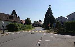
Bollion is a village lying within the municipality of Lully, in the canton of Fribourg, Switzerland. It formerly existed as an autonomous municipality, but on 1 January 2006 was merged, together with Seiry, into the larger Lully.[1]
References
- ↑ "Les «résolutions» de l'Etat" (in French). La Gruyère. 1 June 2006. Archived from the original on 6 July 2011. Retrieved 12 March 2010.
This article is issued from
Wikipedia.
The text is licensed under Creative Commons - Attribution - Sharealike.
Additional terms may apply for the media files.