Estavayer
| Estavayer | |
|---|---|
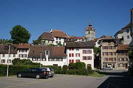 Old City of Estavayer-le-Lac | |
 Estavayer | |
|
Location of Estavayer 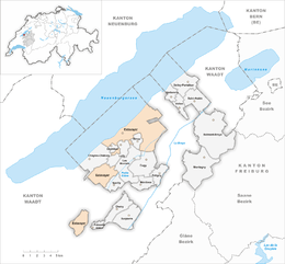 Estavayer Estavayer (Canton of Fribourg) | |
| Coordinates: 46°50′N 6°50′E / 46.833°N 6.833°ECoordinates: 46°50′N 6°50′E / 46.833°N 6.833°E | |
| Country | Switzerland |
| Canton | Fribourg |
| District | Broye |
| Government | |
| • Mayor | André Losey |
| Area[1] | |
| • Total | 40.13 km2 (15.49 sq mi) |
| Lowest elevation (Lake Neuchâtel) | 429 m (1,407 ft) |
| Population (Dec 2017[2]) | |
| • Total | 9,494 |
| • Density | 240/km2 (610/sq mi) |
| Postal code | 1470 |
| SFOS number | 2054 |
| Surrounded by | Les Montets, Cheyres, Payerne (VD), Gorgier (NE), Lully, Saint-Aubin-Sauges (NE), Sévaz, Vaumarcus (NE), Grandcour (VD), Châbles, Chavannes-le-Chêne (VD) |
| Website |
www SFSO statistics |
Estavayer is a municipality of the canton of Fribourg, situated on the south shore of Lake Neuchâtel. Estavayer is located between Yverdon and Bern. It is the capital of the district of Broye. It was created on 1 January 2017 when the former municipalities of Bussy, Estavayer-le-Lac, Morens, Murist, Rueyres-les-Prés, Vernay and Vuissens merged to form Estavayer.[3]
History
Bussy
Bussy is first mentioned in 1142 as Bussey.[4]
Morens
Morens is first mentioned in 1216 as Morens.[5]
Murist
Murist is first mentioned in 1228 as Muris.[6]
Rueyres-les-Prés
Rueyres-les-Prés is first mentioned in 1288 as en Ruere.[7]
Vernay
Vernay was created on 1 January 2006 from the merger of the municipalities of Autavaux, Forel and Montbrelloz.[8]
Geography
Estavayer has an area, as of 2009, of 40.13 km2 (15.49 sq mi).[1]
Population
The new municipality has a population (as of December 2017) of 9,494.[2]
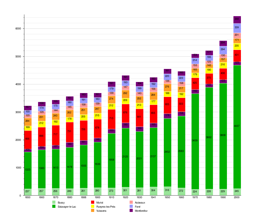
Historic Population
The historical population is given in the following chart:[9]
Heritage sites of national significance
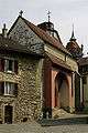
The De Rivaz Chapel, the Sacré-Coeur Chapel, the Chenaux Castle, the Collegiate church of Saint-Laurent, the Convent of the Dominican nuns, the town fortifications, the House de la Dîme and the House des Sires d’Estavayer in Estavayer-le-Lac, the Church of Saint-Maurice in Bussy, the Saint-Pierre Church and the La Molière tower in Murist listed as Swiss heritage site of national significance. The entire town of Estavayer-le-Lac and the villages of Bussy and Vuissens are part of the Inventory of Swiss Heritage Sites. From the 2012 merger of Font into Estavayer-le-Lac, the Gallo-Roman villa at La Vuardaz and the entire Font area (shared between Châbles and Font) were added.[10]
 De Rivaz Chapel
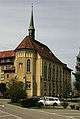 Sacré-Coeur Chapel
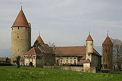
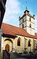 Collegiate church of Saint-Laurent
 Fortifications
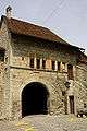 House de la Dîme
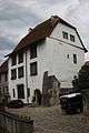 House des Sires d’Estavayer
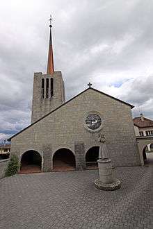 Church of Saint-Maurice
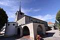 Saint-Pierre Church
 La Molière tower
References
- 1 2 Arealstatistik Standard - Gemeindedaten nach 4 Hauptbereichen
- 1 2 Swiss Federal Statistical Office - STAT-TAB, online database – Ständige und nichtständige Wohnbevölkerung nach institutionellen Gliederungen, Geburtsort und Staatsangehörigkeit (in German) accessed 17 September 2018
- ↑ Historisiertes Gemeindeverzeichnis der Schweiz accessed 5 January 2017
- ↑ Bussy in German, French and Italian in the online Historical Dictionary of Switzerland.
- ↑ Morens in German, French and Italian in the online Historical Dictionary of Switzerland.
- ↑ Murist in German, French and Italian in the online Historical Dictionary of Switzerland.
- ↑ Rueyres-les-Prés in German, French and Italian in the online Historical Dictionary of Switzerland.
- ↑ Amtliches Gemeindeverzeichnis der Schweiz published by the Swiss Federal Statistical Office (in German) accessed 19 July 2011
- ↑ Swiss Federal Statistical Office STAT-TAB Bevölkerungsentwicklung nach institutionellen Gliederungen, 1850-2000 (in German) accessed 27 April 2016
- ↑ "Kantonsliste A-Objekte". KGS Inventar (in German). Federal Office of Civil Protection. 2009. Archived from the original on 28 June 2010. Retrieved 25 April 2011.
External links
| Wikimedia Commons has media related to Estavayer. |
- Estavayer-le-Lac in German, French and Italian in the online Historical Dictionary of Switzerland.
- Vernay in German, French and Italian in the online Historical Dictionary of Switzerland.
- Autavaux in German, French and Italian in the online Historical Dictionary of Switzerland.
- Forel (FR) in German, French and Italian in the online Historical Dictionary of Switzerland.
- Montbrelloz in German, French and Italian in the online Historical Dictionary of Switzerland.
- Vuissens in German, French and Italian in the online Historical Dictionary of Switzerland.