Bloomer, Wisconsin
| Bloomer, Wisconsin | |
|---|---|
| City | |
 Location of Bloomer in Chippewa County, Wisconsin. | |
| Coordinates: 45°6′8″N 91°29′30″W / 45.10222°N 91.49167°WCoordinates: 45°6′8″N 91°29′30″W / 45.10222°N 91.49167°W | |
| Country | United States |
| State | Wisconsin |
| County | Chippewa |
| Government | |
| • Mayor | Jeffrey Steinmetz |
| Area[1] | |
| • Total | 3.09 sq mi (8.00 km2) |
| • Land | 2.94 sq mi (7.61 km2) |
| • Water | 0.15 sq mi (0.39 km2) |
| Elevation[2] | 994 ft (303 m) |
| Population (2010)[3] | |
| • Total | 3,539 |
| • Estimate (2016)[4] | 3,509 |
| • Density | 1,203.7/sq mi (464.8/km2) |
| Time zone | UTC-6 (Central (CST)) |
| • Summer (DST) | UTC-5 (CDT) |
| Area code(s) | 715 & 534 |
| FIPS code | 55-08225[5] |
| GNIS feature ID | 1561930[2] |
| Website |
ci |
Bloomer is a city in Chippewa County in the U.S. state of Wisconsin. As of the 2010 census, the population of the city of Bloomer was 3,539.
History
Mr. Bloomer and a group of men from Galena, Illinois built a mill on the site in 1848. As winter approached he sold the dam to H. S. Allen and returned to Galena. Settled in 1855 the village was known as Vanville until 1867 when it was surveyed and platted.[6]
Geography
Bloomer is located at 45°6′7″N 91°29′30″W / 45.10194°N 91.49167°W (45.102171, −91.491767).[7]
According to the United States Census Bureau, the city has a total area of 3.09 square miles (8.00 km2), of which 2.94 square miles (7.61 km2) is land and 0.15 square miles (0.39 km2) is water.[1]
Bloomer is along U.S. Highway 53 and Wisconsin Highway 40; and also County Roads F, Q, and SS. Wisconsin Highway 64 is nearby.
Demographics
| Historical population | |||
|---|---|---|---|
| Census | Pop. | %± | |
| 1880 | 304 | — | |
| 1890 | 631 | 107.6% | |
| 1900 | 811 | 28.5% | |
| 1910 | 1,204 | 48.5% | |
| 1920 | 1,648 | 36.9% | |
| 1930 | 1,865 | 13.2% | |
| 1940 | 2,204 | 18.2% | |
| 1950 | 2,556 | 16.0% | |
| 1960 | 2,834 | 10.9% | |
| 1970 | 3,143 | 10.9% | |
| 1980 | 3,342 | 6.3% | |
| 1990 | 3,085 | −7.7% | |
| 2000 | 3,347 | 8.5% | |
| 2010 | 3,539 | 5.7% | |
| Est. 2016 | 3,509 | [4] | −0.8% |
| WI Counties 1900–1990 | |||
2010 census
As of the census[3] of 2010, there were 3,539 people, 1,562 households, and 932 families residing in the city. The population density was 1,203.7 inhabitants per square mile (464.8/km2). There were 1,656 housing units at an average density of 563.3 per square mile (217.5/km2). The racial makeup of the city was 97.9% White, 0.3% African American, 0.2% Native American, 0.3% Asian, 0.3% from other races, and 1.0% from two or more races. Hispanic or Latino of any race were 0.8% of the population.
There were 1,562 households of which 28.1% had children under the age of 18 living with them, 46.9% were married couples living together, 9.7% had a female householder with no husband present, 3.1% had a male householder with no wife present, and 40.3% were non-families. 34.5% of all households were made up of individuals and 17.4% had someone living alone who was 65 years of age or older. The average household size was 2.25 and the average family size was 2.89.
The median age in the city was 40.2 years. 23.1% of residents were under the age of 18; 8.2% were between the ages of 18 and 24; 24% were from 25 to 44; 25.8% were from 45 to 64; and 19% were 65 years of age or older. The gender makeup of the city was 47.0% male and 53.0% female.
2000 census
As of the census[5] of 2000, there were 3,347 people, 1,424 households, and 901 families residing in the city. The population density was 1,246.0 people per square mile (480.4/km²). There were 1,487 housing units at an average density of 553.6 per square mile (213.4/km²). The racial makeup of the city was 99.13% White, 0.06% Black or African American, 0.27% Native American, 0.09% Asian, 0.06% from other races, and 0.39% from two or more races. 0.33% of the population were Hispanic or Latino of any race.
There were 1,424 households out of which 27.8% had children under the age of 18 living with them, 53.7% were married couples living together, 7.3% had a female householder with no husband present, and 36.7% were non-families. 32.2% of all households were made up of individuals and 16.6% had someone living alone who was 65 years of age or older. The average household size was 2.31 and the average family size was 2.92.
In the city, the population was spread out with 24.0% under the age of 18, 8.1% from 18 to 24, 26.6% from 25 to 44, 20.7% from 45 to 64, and 20.6% who were 65 years of age or older. The median age was 39 years. For every 100 females, there were 88.4 males. For every 100 females age 18 and over, there were 83.4 males.
The median income for a household in the city was $42,635, and the median income for a family was $57,974.
Education
Bloomer High School is the local high school (9–12). Bloomer Middle School is the local middle school (5–8), Bloomer Elementary School is the local elementary school (4k-4), and Saint Paul Catholic is the local private Catholic school (5k-8).
Recreation
Bloomer hosts an annual jump rope competition[8] and has been called the "jump rope capital of the world",[9] a title it earned after being featured on national television.[10]
References
- 1 2 "US Gazetteer files 2010". United States Census Bureau. Archived from the original on 2012-01-24. Retrieved 2012-11-18.
- 1 2 "US Board on Geographic Names". United States Geological Survey. 2007-10-25. Retrieved 2008-01-31.
- 1 2 "American FactFinder". United States Census Bureau. Retrieved 2012-11-18.
- 1 2 "Population and Housing Unit Estimates". Retrieved June 9, 2017.
- 1 2 "American FactFinder". United States Census Bureau. Archived from the original on 2013-09-11. Retrieved 2008-01-31.
- ↑ History of Bloomer, Wisconsin
- ↑ "US Gazetteer files: 2010, 2000, and 1990". United States Census Bureau. 2011-02-12. Retrieved 2011-04-23.
- ↑ Bloomer Chamber of Commerce. Annual Rope Jump Contest
- ↑ http://www.50states.com/facts/wisconsin.htm#.Uo7I_8R02So
- ↑ http://chippewa.com/news/bloomer-rope-jump-turns/article_f2ab28ed-b560-5cf3-a2a9-3992a6fd8d83.html
External links
- City of Bloomer
- Sanborn fire insurance maps: 1893 1902 1912
Municipalities and communities of Chippewa County, Wisconsin, United States | ||
|---|---|---|
| Cities | 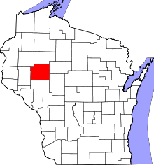 | |
| Villages | ||
| Towns | ||
| CDPs | ||
| Unincorporated communities | ||
| Footnotes | ‡This populated place also has portions in an adjacent county or counties | |