Blandinsville, Illinois
| Blandinsville | |
|---|---|
| Village | |
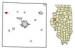 Location of Blandinsville in McDonough County, Illinois. | |
.svg.png) Location of Illinois in the United States | |
| Coordinates: 40°33′17″N 90°51′57″W / 40.55472°N 90.86583°WCoordinates: 40°33′17″N 90°51′57″W / 40.55472°N 90.86583°W | |
| Country | United States |
| State | Illinois |
| County | McDonough |
| Area[1] | |
| • Total | 0.88 sq mi (2.28 km2) |
| • Land | 0.88 sq mi (2.28 km2) |
| • Water | 0.00 sq mi (0.00 km2) |
| Population (2010) | |
| • Total | 651 |
| • Estimate (2016)[2] | 612 |
| • Density | 695.45/sq mi (268.39/km2) |
| Time zone | UTC-6 (CST) |
| • Summer (DST) | UTC-5 (CDT) |
| Area code(s) | 309 |
| FIPS code | 17-06470 |
| Wikimedia Commons | Blandinsville, Illinois |
Blandinsville is a village in McDonough County, Illinois, United States. The population was 777 at the 2000 census.[3]
The town is named for Joseph L. Blandin, owner of the first general store. In 1842, the town was platted on a tract known as Job's Settlement, named after early settlers William and Ira Job. A post office was established in 1843.[4] The Frank Hicks House in Blandinsville was constructed by architect George Franklin Barber in 1895.
Geography
According to the 2010 census, Blandinsville has a total area of 0.88 square miles (2.28 km2), all land.[5] Twin Oaks Golf course is on the western edge of town.
Demographics
| Historical population | |||
|---|---|---|---|
| Census | Pop. | %± | |
| 1860 | 455 | — | |
| 1870 | 1,565 | 244.0% | |
| 1890 | 877 | — | |
| 1900 | 995 | 13.5% | |
| 1910 | 987 | −0.8% | |
| 1920 | 1,002 | 1.5% | |
| 1930 | 952 | −5.0% | |
| 1940 | 914 | −4.0% | |
| 1950 | 918 | 0.4% | |
| 1960 | 853 | −7.1% | |
| 1970 | 922 | 8.1% | |
| 1980 | 886 | −3.9% | |
| 1990 | 762 | −14.0% | |
| 2000 | 777 | 2.0% | |
| 2010 | 651 | −16.2% | |
| Est. 2016 | 612 | [2] | −6.0% |
| U.S. Decennial Census[6] | |||
As of the census[7] of 2000, there were 777 people, 339 households, and 224 families residing in the village. The population density was 878.2 people per square mile (340.9/km²). There were 353 housing units at an average density of 399.0 per square mile (154.9/km²). The racial makeup of the village was 98.71% White, 0.13% Asian, 0.51% from other races, and 0.64% from two or more races. Hispanic or Latino of any race were 0.77% of the population.
There were 339 households out of which 28.9% had children under the age of 18 living with them, 54.0% were married couples living together, 7.4% had a female householder with no husband present, and 33.9% were non-families. 29.8% of all households were made up of individuals and 18.0% had someone living alone who was 65 years of age or older. The average household size was 2.29 and the average family size was 2.83.
In the village, the population was spread out with 22.3% under the age of 18, 8.4% from 18 to 24, 26.5% from 25 to 44, 23.9% from 45 to 64, and 18.9% who were 65 years of age or older. The median age was 41 years. For every 100 females, there were 101.3 males. For every 100 females age 18 and over, there were 98.0 males.
The median income for a household in the village was $30,272, and the median income for a family was $39,028. Males had a median income of $30,625 versus $19,479 for females. The per capita income for the village was $15,203. About 6.8% of families and 8.8% of the population were below the poverty line, including 6.2% of those under age 18 and 7.2% of those age 65 or over.
References
- ↑ "2016 U.S. Gazetteer Files". United States Census Bureau. Retrieved Jun 29, 2017.
- 1 2 "Population and Housing Unit Estimates". Retrieved June 9, 2017.
- ↑ City data, 2000 census information Retrieved on May 28, 2007
- ↑ Callary, Edward (2009). Place Names of Illinois. University of Illinois.
- ↑ "G001 - Geographic Identifiers - 2010 Census Summary File 1". United States Census Bureau. Retrieved 2015-08-02.
- ↑ "Census of Population and Housing". Census.gov. Archived from the original on May 12, 2015. Retrieved June 4, 2015.
- ↑ "American FactFinder". United States Census Bureau. Archived from the original on 2013-09-11. Retrieved 2008-01-31.
Municipalities and communities of McDonough County, Illinois, United States | ||
|---|---|---|
| Cities | ||
| Villages | ||
| Townships | ||
| CDPs | ||
| Other unincorporated communities |
| |
| Ghost towns | ||
| Footnotes | ‡This populated place also has portions in an adjacent county or counties | |