Blairmore, Argyll
Blairmore
| |
|---|---|
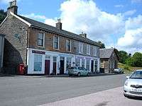 Blairmore Village Hall and shops. | |
 Blairmore Blairmore shown within Argyll and Bute | |
| OS grid reference | NS 19200 82500 |
| Council area |
|
| Lieutenancy area |
|
| Country | Scotland |
| Sovereign state | United Kingdom |
| Post town | DUNOON, ARGYLL |
| Postcode district | PA23 |
| Dialling code | 01369 |
| EU Parliament | Scotland |
| UK Parliament |
|
| Scottish Parliament |
|
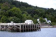
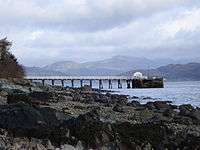
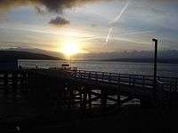
Blairmore Pier
Blairmore is a village located on the Cowal peninsula in Argyll and Bute, Scotland. Blairmore lies within the Loch Lomond and The Trossachs National Park.[1] It is situated on the western shore of Loch Long and around 1 mile (1.6 km) north of Strone. The village was largely built during the Victorian era and has a small wooden pier which dates to 1855.[2][3]
Gallery
Blairmore
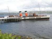
Paddle steamer Waverley about to leave Blairmore pier - geograph.org.uk - 1435364
Blairmore Pier - geograph.org.uk - 752302
Blairmore Pier - geograph.org.uk - 758676
References
- ↑ http://www.lochlomond-trossachs.org/rr-content/uploads/2016/07/Downloadable-map-of-Loch-Lomond-and-the-Trossachs-National-Park.pdf
- ↑ "History of Blairmore in Argyll and Bute | Map and description". Visionofbritain.org.uk. Retrieved 2012-04-05.
- ↑ "Blairmore Pier, Near Strone". The Glasgow Herald. 11 July 1855. p. 1. Retrieved 2012-04-05.
External links
- Map sources for Blairmore, Argyll
- Gaelic place names of Scotland - website
- Blairmore Pier Trust - website
- Blairmore Gallery - website
- Blairmore and Strone Golf Club - website
- Blairmore Heritage - website
- Loch Lomond and The Trossachs National Park - website
| Wikimedia Commons has media related to Blairmore, Argyll and Bute. |
This article is issued from
Wikipedia.
The text is licensed under Creative Commons - Attribution - Sharealike.
Additional terms may apply for the media files.