Black River (Abitibi River tributary)
| Black River | |
| River | |
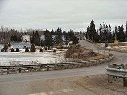 The Vernon L. Miller Memorial Bridge taking Highway 101 across the Black River into the community of Matheson | |
| Country | Canada |
|---|---|
| Province | Ontario |
| Region | Northeastern Ontario |
| Districts | Cochrane, Timiskaming |
| Part of | James Bay drainage basin |
| Source | Unnamed lake |
| - location | Kirkland Lake, Timiskaming District |
| - elevation | 357 m (1,171 ft) |
| - coordinates | 48°13′16″N 79°58′17″W / 48.22111°N 79.97139°W |
| Mouth | Abitibi River |
| - location | Iroquois Falls, Timiskaming District |
| - elevation | 239 m (784 ft) |
| - coordinates | 48°41′58″N 80°38′06″W / 48.69944°N 80.63500°WCoordinates: 48°41′58″N 80°38′06″W / 48.69944°N 80.63500°W |
 Location of the mouth of the Black River in Ontario | |
The Black River is a river in Cochrane District and Timiskaming District in Northeastern Ontario, Canada.[1] It is part of the James Bay drainage basin, and is a right tributary of the Abitibi River. The municipality of Black River-Matheson is named after the river.
Course
The river begins at an unnamed lake in geographic Morrisette Township[2] in the municipality of Kirkland Lake, Timiskaming District, just north of Kirkland Lake Airport, and heads north into geographic Bisley Township[3] in Cochrane District, then turns northwest, and enters geographic Melba Township[4] in the municipality of Black River-Matheson. It takes in the left tributaries Little Black River and Whiteclay River, passes under Ontario Highway 572, takes in the right tributary Pike River, flows through the Black River Generating Station and dam, built in 1929,[5] and passes under Ontario Highway 101 at the community of Matheson. From this point on, the original river course is flooded to the same elevation as the Iroquois Falls Generating Station[6] on the Abitibi River at Iroquois Falls downstream. The Black River continues northwest, takes in the left tributary Watabeag River, enters geographic Walker Township[7] in the municipality of Iroquois Falls, takes in the right tributary Shallow River and left tributary Driftwood River, and reaches its mouth at the Abitibi River. The Abitibi River flows via the Moose River to James Bay.
In Matheson-Black River, from the community of Wavell to the community of Matheson, both Ontario Highway 11 and the Ontario Northland Railway main line follow the river valley.
Tributaries
- Driftwood River (left)
- Shallow River (right)
- Warbler Creek (left)
- Watabeag River (left)
- Russell Creek (left)
- Salve Creek (right)
- Pike River (right)
- Little Wildgoose Creek (left)
- Malloch Creek (left)
- Whiteclay River (left)
- Little Black River (left)
- Barnet Creek (right)
- Melba Creek (left)
- Cochenour Creek (right)
- Kellett Creek (left)
- Bisley Creek (left)
- Gourlay Creek (left)
See also
References
- ↑ "Black River". Geographical Names Data Base. Natural Resources Canada. Retrieved 2014-07-22.
- ↑ "Morrisette" (PDF). Geology Ontario - Historic Claim Maps. Ontario Ministry of Northern Development, Mines and Forestry. Archived from the original (PDF) on 2014-07-29. Retrieved 2014-07-22.
- ↑ "Bisley" (PDF). Geology Ontario - Historic Claim Maps. Ontario Ministry of Northern Development, Mines and Forestry. Archived from the original (PDF) on 2014-07-29. Retrieved 2014-07-22.
- ↑ "Melba" (PDF). Geology Ontario - Historic Claim Maps. Ontario Ministry of Northern Development, Mines and Forestry. Archived from the original (PDF) on 2014-07-29. Retrieved 2014-07-22.
- ↑ "635294 Generating Station (0.52 MW) - Black River". Ontario Power Authority. Archived from the original on 2010-12-23. Retrieved 2014-07-23.
- ↑ "Iroquois Falls Generating Station". H20 Power. Retrieved 2014-07-23.
- ↑ "Walker" (PDF). Geology Ontario - Historic Claim Maps. Ontario Ministry of Northern Development, Mines and Forestry. Archived from the original (PDF) on 2014-07-29. Retrieved 2014-07-22.
Other map sources:
- Map 15 (PDF) (Map). 1 : 1,600,000. Official road map of Ontario. Ministry of Transportation of Ontario. 2014. Retrieved 2014-07-22.
- Restructured municipalities - Ontario map #3 (Map). Restructuring Maps of Ontario. Ontario Ministry of Municipal Affairs and Housing. 2006. Retrieved 2014-07-22.
- Restructured municipalities - Ontario map #4 (Map). Restructuring Maps of Ontario. Ontario Ministry of Municipal Affairs and Housing. 2006. Retrieved 2014-07-22.