Black Eagle, Montana
| Black Eagle, Montana | |
|---|---|
| CDP | |
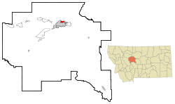 Location of Black Eagle, Montana | |
| Coordinates: 47°31′35″N 111°16′42″W / 47.52639°N 111.27833°WCoordinates: 47°31′35″N 111°16′42″W / 47.52639°N 111.27833°W | |
| Country | United States |
| State | Montana |
| County | Cascade |
| Area | |
| • Total | 1.7 sq mi (4.4 km2) |
| • Land | 1.5 sq mi (4.0 km2) |
| • Water | 0.1 sq mi (0.4 km2) |
| Elevation | 3,379 ft (1,030 m) |
| Population (2010) | |
| • Total | 904 |
| • Density | 530/sq mi (210/km2) |
| Time zone | UTC-7 (Mountain (MST)) |
| • Summer (DST) | UTC-6 (MDT) |
| ZIP code | 59414 |
| Area code(s) | 406 |
| FIPS code | 30-07150 |
| GNIS feature ID | 0802039 |
Black Eagle is a census-designated place (CDP) in Cascade County, Montana, United States. The population was 904 at the 2010 census.[1] It is part of the Great Falls, Montana Metropolitan Statistical Area.
With early activity from smelters and refineries, Black Eagle was first called "Little Chicago".[2][3] This was a reference to the industrialized nature of the town. When the post office was established in 1917 the name of the town officially became Black Eagle. It was named for the Black Eagle Falls on the Missouri River, which were named by Capt. Meriwether Lewis.[3]
Construction of the Boston & Montana smelter, which formed the town's skyline, began in 1891.[3] It was demolished on September 18, 1982.[3]
Geography
Black Eagle is located at 47°31′35″N 111°16′42″W / 47.52639°N 111.27833°W (47.526385, -111.278459).[4]
According to the United States Census Bureau, the CDP has a total area of 1.7 square miles (4.4 km2), of which, 1.5 square miles (3.9 km2) of it is land and 0.1 square miles (0.26 km2) of it (8.33%) is water.
Demographics
As of the census[5] of 2000, there were 914 people, 418 households, and 237 families residing in the CDP. The population density was 590.3 people per square mile (227.7/km²). There were 458 housing units at an average density of 295.8 per square mile (114.1/km²). The racial makeup of the CDP was 88.07% White, 0.55% African American, 7.66% Native American, 0.22% Asian, 0.55% from other races, and 2.95% from two or more races. Hispanic or Latino of any race were 2.52% of the population.
There were 418 households out of which 24.4% had children under the age of 18 living with them, 38.8% were married couples living together, 12.0% had a female householder with no husband present, and 43.1% were non-families. 38.3% of all households were made up of individuals and 11.7% had someone living alone who was 65 years of age or older. The average household size was 2.19 and the average family size was 2.86.
In the CDP, the population was spread out with 23.9% under the age of 18, 8.6% from 18 to 24, 29.1% from 25 to 44, 24.8% from 45 to 64, and 13.6% who were 65 years of age or older. The median age was 38 years. For every 100 females, there were 105.4 males. For every 100 females age 18 and over, there were 104.7 males.
The median income for a household in the CDP was $23,529, and the median income for a family was $31,771. Males had a median income of $26,250 versus $17,321 for females. The per capita income for the CDP was $18,269. About 8.1% of families and 11.1% of the population were below the poverty line, including 10.1% of those under age 18 and 3.8% of those age 65 or over.
Climate
According to the Köppen Climate Classification system, Black Eagle has a semi-arid climate, abbreviated "BSk" on climate maps.[6]
References
- ↑ "Profile of General Population and Housing Characteristics: 2010 Demographic Profile Data (DP-1): Black Eagle CDP, Montana". U.S. Census Bureau, American Factfinder. Archived from the original on September 11, 2013. Retrieved January 26, 2012.
- ↑ Carkeek Cheney, Roberta (1983). Names on the Face of Montana. Missoula, Montana: Mountain Press Publishing Company. p. 5. ISBN 0-87842-150-5.
- 1 2 3 4 "Montana Place Names Companion". Montana Historical Society. Retrieved 25 July 2017.
- ↑ "US Gazetteer files: 2010, 2000, and 1990". United States Census Bureau. 2011-02-12. Retrieved 2011-04-23.
- ↑ "American FactFinder". United States Census Bureau. Archived from the original on 2013-09-11. Retrieved 2008-01-31.
- ↑ Climate Summary for Black Eagle, Montana
| Communities of the Great Falls Metro area | |||||||
|---|---|---|---|---|---|---|---|
| Geography | |||||||
| History | |||||||
| Education |
| ||||||
| Media |
| ||||||
| Services |
| ||||||
| Sports |
| ||||||
| Breweries | |||||||
| Notable people | |||||||
| |||||||
Municipalities and communities of Cascade County, Montana, United States | ||
|---|---|---|
| City | 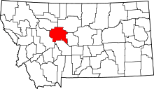 | |
| Towns | ||
| CDPs | ||
| Unincorporated community | ||