Biriniwa
| Biriniwa | |
|---|---|
| LGA and town | |
 Biriniwa Location in Nigeria | |
| Coordinates: 12°47′0″N 10°14′0″E / 12.78333°N 10.23333°E | |
| Country |
|
| State | Jigawa State |
| Time zone | UTC+1 (WAT) |
Biriniwa is a Local Government Area of Jigawa State, Nigeria. Its headquarters are in the town of Biriniwa.
It has an area of 1,567 km² and a population of 142,329 at the 2006 census.
The people are predominately farmers
The postal code of the area is 731.[1]
References
- ↑ "Post Offices- with map of LGA". NIPOST. Archived from the original on 2009-10-07. Retrieved 2009-10-20.
State capital: Dutse | ||
| Local Government Areas | 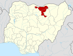 | |
This article is issued from
Wikipedia.
The text is licensed under Creative Commons - Attribution - Sharealike.
Additional terms may apply for the media files.