Kosovo Pomoravlje
| Anamorava Anamorava or Anamoravë (Albanian) Kosovsko Pomoravlje (Serbian) | |
|---|---|
| Valley | |
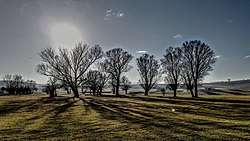 Landscape in Anamorava | |
| Country | Kosovo |
| Area | |
| • Total | 650 km2 (250 sq mi) |
Kosovo Pomoravlje Anamorava (Albanian: Anamoravë or (Serbian: Косовско Поморавље / Kosovsko Pomoravlje, "Pomoravlje of Kosovo") ), is a valley in Kosovo, in the southern part of the District of Gjilan surrounding the Binač Morava River. It stretches eastward to the Preševo Valley in southern Serbia. The mountains in this region, rising to an altitude of 1,000–1,200 metres (3,300–3,900 ft), border the Skopska Crna Gora region in neighboring Macedonia north of Skopje.[1] Gjilan, Kosovska Kamenica, Novo Brdo and Vitina are municipalities located in the region. The region gave its name to Kosovo Pomoravlje District. It is known for recording the lowest temperature in Kosovo: −32.5 °C (−26.5 °F), on 25 January 1963.[2]
Location
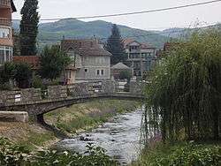
Kosovo Pomoravlje District was a district of Serbia until 1999. After the United Nations Interim Administration Mission in Kosovo took control in 1999, it was transformed into the District of Gjilan. Pomoravlje is about 50 kilometres (31 mi) long and 15 kilometres (9.3 mi) wide. It is bordered by the Skopska Crna Gora mountains in the south and the Goljak in the north, and borders Kosovo field in the west. On the east, it borders the Morava Valley. The region's largest cities are Gjilan and Bujanovac.
Name
The region is known as Kosovsko Pomoravlje (Косовско Поморавље, "Morava Valley of Kosovo") in Serbian and as Lugina e Anamoraves Binçes ("Valley of Binač Morava") in Albanian. Its name is derived from the Binač Morava River, which flows through northern Macedonia, eastern Kosovo and southern Serbia as part of the Great Morava river system.
Geography
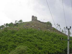
The region includes part of the valley and the Karadak and Koznik mountains. Gjilan has six municipalities and 287 smaller settlements.[3] The spa in Klokot has several thermal springs valued for their medicinal qualities.[4]
Climate
At an altitude of 410 metres (1,350 ft) above sea level, the region has a continental climate with light winds (usually from the northeast). Rainfall is light, and winter often brings snow from the west; northern and western winds tend to bring rain. The region's average annual temperature is 10.6 °C (51.1 °F). January's average is −0.9 °C (30.4 °F), and July's is 20.7 °C (69.3 °F).[5][6]
Hydrography
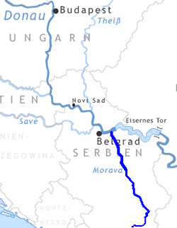
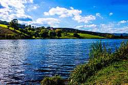
Tributaries of the Morava river system include the Karadak and Lapušnica rivers. The Preševo Valley is a corridor between the Morava and Vardar valleys, and the Morava valley's wetlands are home to many species of birds.
Transportation
Rail traffic passes through the valley near the tributaries.[7]
Notes
| a. | ^ Kosovo is the subject of a territorial dispute between the Republic of Kosovo and the Republic of Serbia. The Republic of Kosovo unilaterally declared independence on 17 February 2008, but Serbia continues to claim it as part of its own sovereign territory. The two governments began to normalise relations in 2013, as part of the Brussels Agreement. Kosovo has received formal recognition as an independent state from 113 out of 193 United Nations member states. |
References
- ↑ Robert Elsie (15 November 2010). Historical Dictionary of Kosovo. Scarecrow Press. pp. 29–. ISBN 978-0-8108-7483-1.
- ↑ in Gnjilane - AccuWeather Forecast for Gjilan Kosovo
- ↑ Академик Божидар Видоески, Говорот на Скопска Црногорија: МЈ, 1954, V, 1, стр.1-30; 2, стр. 109-196: 2 к
- ↑ "Komunat në rajonin e Gjilanit".
- ↑ in Gnjilane - Ravine of Lapushnica (Gjilan)- AccuWeather Forecast for Gjilan Kosovo
- ↑ Riza Çavolli: Geography Regional in Kosovo:,publisher ETMMK, Prishtina, 1997.
- ↑ -Transporti nė Kosovė Transportation - Kosovo Pomoravlje
Bibliography
- Urošević, Atanasije (1935). "Горња Морава и Изморник". СЕ3 51, Насеља и порекло становништва 28. Belgrade.
- Urošević, Atanasije (1931). "Гњилане". Гласник Географског друштва, св. XVII. Belgrade.
- Urošević, Atanasije (1935). Gornja Morava i izmornik. Mlada Srbnja.