Billinudgel, New South Wales
| Billinudgel New South Wales | |||||||||
|---|---|---|---|---|---|---|---|---|---|
 Shops in Wilfred Street—Billinudgel's main street | |||||||||
|
Billinudgel | |||||||||
| Coordinates | 28°30′S 153°32′E / 28.500°S 153.533°ECoordinates: 28°30′S 153°32′E / 28.500°S 153.533°E | ||||||||
| Population | 218 (2016 census)[1] | ||||||||
| Postcode(s) | 2483 | ||||||||
| Elevation | 2 m (7 ft) | ||||||||
| Location | |||||||||
| LGA(s) | Byron Shire Council | ||||||||
| State electorate(s) | Ballina | ||||||||
| Federal Division(s) | Richmond | ||||||||
| |||||||||
Billinudgel is a town in the Northern Rivers region of New South Wales, Australia, and is part of Byron Shire. It used to be a railway town with many fruits and vegetable loaded onto the local railway. Since the railway is no longer used in Billinudgel, it has nearly joined to the nearby town of Ocean Shores. The area was bypassed by a heavily upgraded Pacific Highway in July 2007.
Climate
Billinudgel has a mild climate with winter frosts and warm wet summers.
Name
The name Billinudgel is derived from Bundjalung Bilihnadhihl, meaning "once belonged to a parrot".[2][3]
Gallery
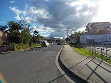 Wilfred Street, approaching the town centre
 A private residence in Wilfred Street
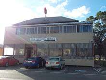 Billinudgel Hotel
References
- ↑ Australian Bureau of Statistics (27 June 2017). "Billinudgel (State Suburb)". 2016 Census QuickStats. Retrieved 18 March 2018.

- ↑ Sharpe, Margaret. "Bundjalung". Macquarie Aboriginal Words. Sydney: Macquarie Library. p. 21.
- ↑ "Billinudgel". Geographical Names Register (GNR) of NSW. Geographical Names Board of New South Wales. Retrieved 13 June 2009.
This article is issued from
Wikipedia.
The text is licensed under Creative Commons - Attribution - Sharealike.
Additional terms may apply for the media files.