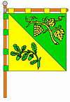
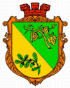
Bilky, Irshava Raion
| Bilky, Irshava Raion Білки (Іршавський район) | |||
|---|---|---|---|
| village | |||
| |||
 Bilky, Irshava Raion | |||
| Coordinates: 48°19′46″N 23°08′23″E / 48.32944°N 23.13972°ECoordinates: 48°19′46″N 23°08′23″E / 48.32944°N 23.13972°E | |||
| Country |
| ||
| Province |
| ||
| District |
| ||
| Established | 1245 | ||
| Area | |||
| • Total | 4,4 km2 (17 sq mi) | ||
| Elevation/(average value of) | 175 m (574 ft) | ||
| Population | |||
| • Total | 8,064 | ||
| • Density | 180/km2 (470/sq mi) | ||
| Time zone | UTC+2 (EET) | ||
| • Summer (DST) | UTC+3 (EEST) | ||
| Postal code | 90132 | ||
| Area code | +380 3144 | ||
| Website | селище Білки, райцентр Іршава (Ukrainian) | ||
Bilky (Ukrainian: Бі́лки; Hungarian: Bilke, Ilosvai járás) is a village in Irshava Raion of Zakarpattia Oblast, Ukraine.
The village covers an area of 4,4 km2.[1] The population of village is about 8 064 persons and Local government is administered by Bilkivska village council.[2]
Geography
Village Bilky located in the center of the Transcarpathian region (Zakarpattia Oblast) on the altitude of 175 metres (570 ft) above sea level, that is situated in the river valley Borzhava.
It is at a distance 93 kilometres (58 mi) from the regional center of Uzhhorod, 11 kilometres (6.8 mi) from the district center Irshava, and 52 kilometres (32 mi) from the Mukacheve.
History
The first written record of village Bilky dates back to the 17th century. By King Béla IV of Hungary, King of Hungary and Croatia, was made a present and gave royal charter in 1245.
But in the village found the remains of three settlements in of the Neolithic (IV-III millennium BC). Been preserved remains of the Slavic of the settlement 8th-9th century AD.
Religious organizations
In the village there are religious community of the Ukrainian Greek Catholic Church and Ukrainian Orthodox Church. There are two temples.
- Church of Saints Peter and Paul of Ukrainian Orthodox Church (1939).
- Holy Assumption church of Ukrainian Greek Catholic Churches (UGCC) (1838).
References
- ↑ Село Білки (Закарпатська обл.): карта вулиць (in Ukrainian)
- ↑ Білківська сільська рада (in Ukrainian)
External links
- Про село Білки з енциклопедіїї міст і сіл УРСР, Закарпатська область (in Ukrainian)
- weather.in.ua/ Bilky (Zakarpattia (Transcarpathian) region)
- Друга проща закарпатських журналістів пролягла Боржавською долиною (in Ukrainian)
- Церква Успіння/Білки Іршавський район (in Ukrainian)
- Церква св. Петра і Павла/Білки Іршавський район (in Ukrainian)

