Big Creek (Geauga County, Ohio)
| Big Creek | |
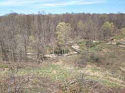 The upper reaches of Big Creek near Chardon | |
| Country | United States |
|---|---|
| State | Ohio |
| Source | |
| - location | Chardon |
| - elevation | 1,130 ft (344 m) From USGS Chardon, Ohio topographical map |
| - coordinates | 41°35′32″N 81°11′21″W / 41.592159°N 81.189272°W |
| Mouth | Grand River |
| - elevation | 610 ft (186 m) from USGS ArcGIS web application. |
| - coordinates | 41°42′26″N 81°13′48″W / 41.7072675°N 81.2301013°WCoordinates: 41°42′26″N 81°13′48″W / 41.7072675°N 81.2301013°W |
| Length | 15.6 mi (25 km) |
| Basin | 50 sq mi (129 km2) |
 Location of the mouth within Ohio | |
Big Creek is a 15.6-mile-long (25.1 km) tributary of the Grand River and flows through Lake and Geauga counties in Ohio.[1] It rises near Chardon, Ohio and joins the Grand River in Painesville Township in Helen Hazen Wyman Park.[2][3]
The creek exposes rock formations from the Paleozoic Era, including the fossiliferous Chagrin Shale.[4]
With a watershed of 50 square miles (130 km2) its tributaries include Cutts, Jenks, Aylworth, East, Gordon and Kellogg Creeks.[3][5] It has previously been known as Bigg Creek, and West Creek.[1]
Big Creek flows through a number of parks, and is known for its fishing of smallmouth bass, and steelhead trout that spawn in the creek.[2][3][6]
History
Although now an area for recreation including hiking, fishing and camping the Big Creek valley was once a place of industrial activity with saw mills, iron furnaces and a leather tannery.[2][3] One of the mills was owned by Eber Howe a local newspaper editor and abolitionist, who used the mill as a "station" on the Underground railroad for slaves who were escaping to Canada by crossing Lake Erie at Painesville. As the route allowed the slaves to reach liberty, the mill became known as Liberty Hollow.[2]
Pease Hollow (now at the corner of Cascade Road and Girdled Road) was the site of a mill that was built by David Pease and used to power lathes and tools for turning wood to make furniture & small wares.[7] Griswold Hollow (now Clark Road from Robinson Road to the Concord Township Line)[8] was the site of a small sandstone quarry (along Jenks Creek) that was noted in a Geological Survey of the area in 1912.
See also
References
- 1 2 U.S. Geological Survey Geographic Names Information System: Big Creek
- 1 2 3 4 "Liberty Hollow". Lake Metroparks. Retrieved 12 January 2018.
- 1 2 3 4 "Helen Hazen Wyman Park". Lake Metroparks. Retrieved 12 January 2018.
- ↑ Bulletin. State of Ohio, Department of Natural Resources, Division of Geological Survey. 1912.
- ↑ Ohio Department of Natural Resources. "Gazetteer of Ohio Streams" (PDF). Retrieved 12 January 2018.
- ↑ "Big Creek Park". Geauga Park District. Retrieved 12 January 2018.
- ↑ "Ohio Ghost Towns County Data Charts". ohioghosttowns.org. Retrieved 2018-01-15.
- ↑ "GEAUGA COUNTY OHIO - Place Names (A to Z)".