Bidyadanga Community, Western Australia
| Bidyadanga Western Australia | |
|---|---|
 Bidyadanga | |
| Coordinates | 18°41′04″S 121°46′39″E / 18.68442°S 121.77748°ECoordinates: 18°41′04″S 121°46′39″E / 18.68442°S 121.77748°E |
| Population | 555 (2016 census)[1] |
| Postcode(s) | 6725 |
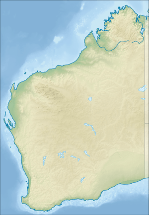
| Location | 190 km (118 mi) S of Broome, Western Australia |
| LGA(s) | Shire of Broome |
| State electorate(s) | Kimberley |
| Federal Division(s) | Durack |
Bidyadanga is a large Aboriginal community, located approximately 190 kilometres south of Broome in the Kimberley Region of WA.[2] The locality received Australia's highest May temperature of 40.6 °C (105.1 °F) on 6 May 1990.[3]
Community
It is the largest Aboriginal community in the state and supports a population of approximately 750 people.[4] The community has been involved in publications of local stories.[5]
The Bidyadanga Aboriginal Community La Grange Inc. (BACLG) was incorporated in 1975 as a not-for-profit organisation to administer government-funded programs.[6]
Native title
The community is located within the Determined Karajarri Area A Native Title claim area.
Governance
The community is managed by the Bidyadanga Aboriginal Community La Grange Incorporated. The corporation was formed under the Aboriginal Communities Act 1979 (WA).
Town planning
Bidyadanga Layout Plan No.3 has been prepared in accordance with State Planning Policy 3.2 (Aboriginal Settlements). Layout Plan No.3 was endorsed by the community on 15 November 2012 and the WAPC on 28 May 2013. The Layout Plan map-set and background report can be viewed at the Planning Western Australia official site at http://www.planning.wa.gov.au/CommunityLayoutPlans/1327.asp.[7]
Climate
| Climate data for Bidyadanga, Western Australia | |||||||||||||
|---|---|---|---|---|---|---|---|---|---|---|---|---|---|
| Month | Jan | Feb | Mar | Apr | May | Jun | Jul | Aug | Sep | Oct | Nov | Dec | Year |
| Record high °C (°F) | 45.7 (114.3) |
45.0 (113) |
44.0 (111.2) |
42.8 (109) |
40.6 (105.1) |
36.2 (97.2) |
36.6 (97.9) |
38.2 (100.8) |
42.4 (108.3) |
45.2 (113.4) |
46.5 (115.7) |
47.0 (116.6) |
47 (116.6) |
| Average high °C (°F) | 34.4 (93.9) |
34.1 (93.4) |
35.4 (95.7) |
35.7 (96.3) |
32.5 (90.5) |
29.8 (85.6) |
29.6 (85.3) |
31.1 (88) |
32.9 (91.2) |
34.4 (93.9) |
35.0 (95) |
35.0 (95) |
33.3 (91.9) |
| Average low °C (°F) | 26.0 (78.8) |
25.6 (78.1) |
24.9 (76.8) |
22.1 (71.8) |
18.4 (65.1) |
15.5 (59.9) |
14.1 (57.4) |
14.9 (58.8) |
17.6 (63.7) |
21.2 (70.2) |
24.1 (75.4) |
25.8 (78.4) |
20.8 (69.4) |
| Record low °C (°F) | 18.0 (64.4) |
16.7 (62.1) |
17.8 (64) |
11.7 (53.1) |
8.6 (47.5) |
3.9 (39) |
3.9 (39) |
5.0 (41) |
7.1 (44.8) |
8.9 (48) |
16.3 (61.3) |
17.0 (62.6) |
3.9 (39) |
| Average precipitation mm (inches) | 129.1 (5.083) |
139.5 (5.492) |
94.9 (3.736) |
25.0 (0.984) |
25.0 (0.984) |
19.6 (0.772) |
8.2 (0.323) |
2.3 (0.091) |
1.3 (0.051) |
1.2 (0.047) |
7.6 (0.299) |
59.1 (2.327) |
516.4 (20.331) |
| Average rainy days | 6.3 | 6.2 | 4.5 | 1.3 | 1.4 | 1.1 | 0.5 | 0.3 | 0.1 | 0.2 | 0.6 | 2.6 | 25.1 |
| Source: [8] | |||||||||||||
References
- ↑ Australian Bureau of Statistics (27 June 2017). "Bidyadanga (ILOC)". 2016 Census QuickStats. Retrieved 18 March 2018.

- ↑ http://www.bidyadanga.org.au/
- ↑ "Extremes for May 2018". Bureau of Meteorology. Retrieved 7 June 2018.
- ↑ Government of Western Australia (October 2008). Bidyadanga Community Layout Plan Number 2
- ↑ Bidyadanga Community; Thompson, Liz; Bidyadanga Community (2011), The danger seed : lirrinngkirn dreaming, Pearson Australia, ISBN 978-1-4425-4694-3
- ↑ Bidyadanga Aboriginal Community, La Grange (2012), Bidyaganga Aboriginal Community La Grange Inc, Bidyadanga Aboriginal Community, La Grange Inc., retrieved 6 February 2013
- ↑ Government of Western Australia. Bidyadanga (La Grange) draft plan
- ↑ "Climate Statistics for Bidyadanga". Australian Bureau of Meteorology. Retrieved 7 June 2018.