Bhuji
| Bhuji भुजी | |
|---|---|
| Village development committee | |
 Bhuji Location in Nepal | |
| Coordinates: 27°29′N 86°17′E / 27.48°N 86.28°ECoordinates: 27°29′N 86°17′E / 27.48°N 86.28°E | |
| Country |
|
| Zone | Janakpur Zone |
| District | Ramechhap District |
| Population (1991) | |
| • Total | 2,285 |
| Time zone | UTC+5:45 (Nepal Time) |
Bhuji is a village development committee in Ramechhap District in the Janakpur Zone of north-eastern Nepal. At the time of the 1991 Nepal census it had a population of 2285 people living in 450 individual households.[1]
Around 80 percent of people are Sunuwar/सुऩुवाऱ/मुखीय in Bhuji. They depend on agriculture and some of them work in the British Gurkha Army and Indian Gurkha Army, and in Gulf countries.
In Bhuji there is one Kastheme High School, which is up to 10 class and two primary level schools.
External links
References
- ↑ "Nepal Census 2001", Nepal's Village Development Committees, Digital Himalaya, archived from the original on 12 October 2008, retrieved 15 November 2009 .
Headquarters: Bidur | ||
| Municipalities | 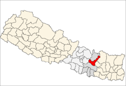 | |
| Rural municipalities |
| |
| Former VDCs |
| |
This article is issued from
Wikipedia.
The text is licensed under Creative Commons - Attribution - Sharealike.
Additional terms may apply for the media files.