Bharella
| Bharella ভারেল্লা | |
|---|---|
| Union | |
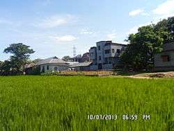 A Snap of East Kangshanagar | |
 Bharella | |
| Coordinates: 23°33′02″N 91°03′24″E / 23.550612°N 91.056561°ECoordinates: 23°33′02″N 91°03′24″E / 23.550612°N 91.056561°E | |
| Country |
|
| Division | Chittagong |
| District | Comilla |
| Upzilla | Burichang Upazila |
| Population (2013) | |
| • Total | 44,656[1] |
| Time zone | UTC+06:00 (BST) |
| Website |
varellaup |
Bharella (Bengali: ভারেল্লা) is a union in Bangladesh. It is situated in the Comilla District of Chittagong Division. which is situated in Burichang Upazila.[2] It stands besides the river of Gumti.[3] Approximately 44656 people live in Bharella.[1]
Market
A market name Kangshanagar Bazar (কংশনগর বাজার) is situated here.[4] It approximately 26 square kilometers size.[5]
Transport
Comilla-Sylhet Highway is a main road which by people of this city communicate with whole country.[6] A road from Kangshanagar goes to Nimsha.[6]
Education
There are 3 educational institutions in Bharella. They are Bharella Shah Nuruddin High School,[7] Bharella Government Primary School.[8]
Government offices
A branch of government bank Sonali Bank is situated here.[9]
References
- 1 2 "population". Archived from the original on 2013-12-03.
- ↑ "Upzilla". Archived from the original on 2014-02-09.
- ↑ "river". Archived from the original on 2013-12-03.
- ↑ Rahman, Mahfuzur (2012). "Burichang Upazila". In Islam, Sirajul; Jamal, Ahmed A. Banglapedia: National Encyclopedia of Bangladesh (Second ed.). Asiatic Society of Bangladesh.
- ↑ "Market". Archived from the original on 2013-12-02.
- 1 2 "communication". Archived from the original on 2013-12-03.
- ↑ "High School".
- ↑ "Primary School".
- ↑ "Bank (Use "Comilla" to find out)".
External links
This article is issued from
Wikipedia.
The text is licensed under Creative Commons - Attribution - Sharealike.
Additional terms may apply for the media files.