Trerulefoot
Coordinates: 50°24′18″N 4°20′53″W / 50.405°N 4.348°W
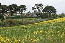
View towards Trerulefoot
Trerulefoot (pronounced /ˈtruːlfʊt/) is a village in southeast Cornwall, England, United Kingdom. It is located on the A38 trunk road approximately halfway between the towns of Saltash and Liskeard.[1] Trerulefoot has a farm shop, two cafés and a petrol filling station.
Bethany is a small hamlet near to Trerulefoot at 50°24′58″N 4°21′58″W / 50.416°N 4.366°W.
References
External links
![]()
Cornwall Portal | |
| Unitary authorities | |
| Major settlements |
|
| Rivers | |
| Topics | |
This article is issued from
Wikipedia.
The text is licensed under Creative Commons - Attribution - Sharealike.
Additional terms may apply for the media files.