Bestwood Park
| Bestwood Park | |
|---|---|
 Bestwood Park Church | |
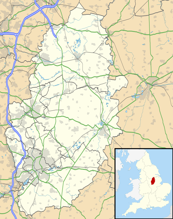
 Bestwood Park Bestwood Park shown within Nottinghamshire | |
| Population | 7,196 [1] |
| OS grid reference | SK 56568 45417 |
| District | |
| Shire county | |
| Region | |
| Country | England |
| Sovereign state | United Kingdom |
| Post town | NOTTINGHAM |
| Postcode district | NG5 |
| Dialling code | 0115 |
| Police | Nottinghamshire |
| Fire | Nottinghamshire |
| Ambulance | East Midlands |
| EU Parliament | East Midlands |
| UK Parliament | |
Bestwood Park Estate is a large council estate located to the north of the city of Nottingham, England, and roughly bounded by Beckhampton Road, Oxclose Lane and Queens Bower Road,[2]
Origins
It is distinct from the older Bestwood Estate to the west. Development began during the late 1950s and early 1960s, whereas Bestwood Estate was developed during the 1930s.
Schools
Glade Hill Primary and Nursery School and Robin Hood Primary School.
Churches
Green Areas
Sandy Banks Local Nature Reserve (LNR), and Glade Hill wood. The latter is on a small hill and so visible from all around. It is erroneously known locally as "Bendigo's Ring" since the original place of this name, in Bestwood Estate, is much less visible.[3]
Bus Services
■ 79: Nottingham → Alfreton Road → Nuthall Road → Cinderhill → Bulwell → Rise Park → Warren Hill → Bestwood Park → Arnold[4]
■ 79A: Nottingham → Alfreton Road → Nuthall Road → Cinderhill → Bulwell → Rise Park → Top Valley → Bestwood Park → Arnold[5]
■ 88: Nottingham → NCN Clarendon College → Sherwood → City Hospital → Edwards Lane → Bestwood Park → Top Valley → Warren Hill[6]
■ 89: Nottingham → NCN Clarendon College → Sherwood → City Hospital → Edwards Lane → Bestwood Park → Rise Park[7]
■ 89A: Nottingham → NCN Clarendon College → Sherwood → City Hospital → Edwards Lane → Bestwood Park → Warren Hill → Rise Park[8]
■ A2: Bestwood Park → Edwards Lane → Ring Road → Trinity/Bluecoat/Nottingham Academy[9]
■ N89: Nottingham → Hucknall Road → City Hospital → Edwards Lane → Bestwood Park → Rise Park → Top Valley[10]
- Nottingham Community Transport
■ L11: Beeston → Wollaton Vale → Bilborough → Aspley Lane → Basford → Bulwell → Top Valley → Bestwood Park → Arnold[11]
References
- ↑
- ↑ "Nottingham/Bestwood Park". openstreetmap.org. 2009-11-06. Retrieved 2016-04-20.
- ↑ Tony Proctor (2013-11-15). "Where is Bendigo's Ring?". Parallax View Blog. Retrieved 2016-04-20.
- ↑ wearebase.com, Base,. "Service 79 on Turquoise Line". www.nctx.co.uk.
- ↑ wearebase.com, Base,. "Service 79A on Turquoise Line". www.nctx.co.uk.
- ↑ wearebase.com, Base,. "Service 88 on Purple Line". www.nctx.co.uk.
- ↑ wearebase.com, Base,. "Service 89 on Purple Line". www.nctx.co.uk.
- ↑ wearebase.com, Base,. "Service 89A on Purple Line". www.nctx.co.uk.
- ↑ wearebase.com, Base,. "Service A2 on Grey Line". www.nctx.co.uk.
- ↑ wearebase.com, Base,. "Service N89 on Purple Line". www.nctx.co.uk.
- ↑ wearebase.com, Base,. "Locallink Service L11 ran by Nottingham Community Transport". www.nctx.co.uk.