Bernie, Missouri
| Bernie, Missouri | |
|---|---|
| City | |
 Location of Bernie, Missouri | |
| Coordinates: 36°40′15″N 89°58′10″W / 36.67083°N 89.96944°WCoordinates: 36°40′15″N 89°58′10″W / 36.67083°N 89.96944°W | |
| Country | United States |
| State | Missouri |
| County | Stoddard |
| Area[1] | |
| • Total | 1.31 sq mi (3.39 km2) |
| • Land | 1.31 sq mi (3.39 km2) |
| • Water | 0 sq mi (0 km2) |
| Elevation | 302 ft (92 m) |
| Population (2010)[2] | |
| • Total | 1,958 |
| • Estimate (2016)[3] | 1,933 |
| • Density | 1,500/sq mi (580/km2) |
| Time zone | UTC-6 (Central (CST)) |
| • Summer (DST) | UTC-5 (CDT) |
| ZIP code | 63822 |
| Area code(s) | 573 |
| FIPS code | 29-04960[4] |
| GNIS feature ID | 0713988[5] |
| Website | City of Bernie, Missouri |
Bernie is a city in Stoddard County, Missouri, United States. The population was 1,958 at the 2010 census.
History
Bernie was laid out in 1890, and named after Bernice "Bernie" Crumb, the daughter of an early Euro-American settler.[6] A post office called Bernie has been in operation since 1889.[7] The city was incorporated in 1889.[8] Bernie was situated along the St. Louis Southwestern Railway.[9]
Geography
Bernie is located at 36°40′15″N 89°58′10″W / 36.67083°N 89.96944°W (36.670876, -89.969403).[10]
According to the United States Census Bureau, the city has a total area of 1.31 square miles (3.39 km2), all land.[1]
Demographics
| Historical population | |||
|---|---|---|---|
| Census | Pop. | %± | |
| 1900 | 333 | — | |
| 1910 | 742 | 122.8% | |
| 1920 | 1,571 | 111.7% | |
| 1930 | 1,031 | −34.4% | |
| 1940 | 1,160 | 12.5% | |
| 1950 | 1,308 | 12.8% | |
| 1960 | 1,578 | 20.6% | |
| 1970 | 1,641 | 4.0% | |
| 1980 | 1,975 | 20.4% | |
| 1990 | 1,847 | −6.5% | |
| 2000 | 1,777 | −3.8% | |
| 2010 | 1,958 | 10.2% | |
| Est. 2016 | 1,933 | [3] | −1.3% |
| U.S. Decennial Census[11] | |||
As of 2000 the median income for a household in the city was $24,085, and the median income for a family was $30,847. Males had a median income of $24,922 versus $16,196 for females. The per capita income for the city was $13,096. About 15.8% of families and 26.6% of the population were below the poverty line, including 28.1% of those under age 18 and 28.3% of those age 65 or over.
2010 census
As of the census[2] of 2010, there were 1,958 people, 831 households, and 549 families residing in the city. The population density was 1,494.7 inhabitants per square mile (577.1/km2). There were 916 housing units at an average density of 699.2 per square mile (270.0/km2). The racial makeup of the city was 94.89% White, 2.20% Black or African American, 0.61% Native American, 0.10% Asian, 0.77% from other races, and 1.43% from two or more races. Hispanic or Latino of any race were 1.43% of the population.
There were 831 households of which 32.1% had children under the age of 18 living with them, 47.4% were married couples living together, 13.6% had a female householder with no husband present, 5.1% had a male householder with no wife present, and 33.9% were non-families. 29.1% of all households were made up of individuals and 14.7% had someone living alone who was 65 years of age or older. The average household size was 2.36 and the average family size was 2.91.
The median age in the city was 40 years. 24.5% of residents were under the age of 18; 8.2% were between the ages of 18 and 24; 23.9% were from 25 to 44; 26.2% were from 45 to 64; and 17.3% were 65 years of age or older. The gender makeup of the city was 47.1% male and 52.9% female.
Education
Bernie R-XIII School District operates one elementary school and Bernie Junior High/High School.[12]
The town has a lending library, the Bernie Public Library.[13]
Notable people
- Carl Edward Bailey, 31st Governor of Arkansas from 1937 to 1941, was born in Bernie in 1894.[14]
- Narvel Felts, a member of the Rockabilly Hall of Fame, attended Bernie High School.[15]
References
- 1 2 "US Gazetteer files 2010". United States Census Bureau. Archived from the original on 2012-07-14. Retrieved 2012-07-08.
- 1 2 "American FactFinder". United States Census Bureau. Retrieved 2012-07-08.
- 1 2 "Population and Housing Unit Estimates". Retrieved June 9, 2017.
- ↑ "American FactFinder". United States Census Bureau. Archived from the original on 2013-09-11. Retrieved 2008-01-31.
- ↑ "US Board on Geographic Names". United States Geological Survey. 2007-10-25. Retrieved 2008-01-31.
- ↑ "Stoddard County Place Names, 1928–1945". The State Historical Society of Missouri. Archived from the original on June 24, 2016. Retrieved December 26, 2016.
- ↑ "Post Offices". Jim Forte Postal History. Retrieved 26 December 2016.
- ↑ "Bernie, Missouri". City-Data.com. Retrieved August 21, 2012.
- ↑ History of Southeast Missouri: A Narrative Account of Its Historical Progress, Its People and Its Principal Interests, Volume 1. Lewis Publishing Company. 1912. p. 391.
- ↑ "US Gazetteer files: 2010, 2000, and 1990". United States Census Bureau. 2011-02-12. Retrieved 2011-04-23.
- ↑ "Census of Population and Housing". Census.gov. Archived from the original on April 22, 2013. Retrieved June 4, 2015.
- ↑ "Bernie R-XIII School District". Bernie R-XIII School District. Retrieved August 21, 2012.
- ↑ "Missouri Public Libraries". PublicLibraries.com. Retrieved 17 March 2018.
- ↑ "Arkansas Governor Carl Edward Bailey". National Governors Association. Retrieved August 21, 2012.
- ↑ "Narvel Felts". Songbird.Me. Retrieved August 21, 2012.
External links
- City website
- Historic maps of Bernie in the Sanborn Maps of Missouri Collection at the University of Missouri
Municipalities and communities of Stoddard County, Missouri, United States | ||
|---|---|---|
| Cities | 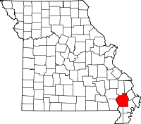 | |
| Villages | ||
| Townships | ||
| CDP | ||
| Other unincorporated communities | ||
| Ghost towns | ||