Advance, Missouri
| Advance, Missouri | |
|---|---|
| City | |
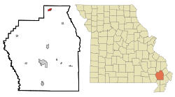 Location of Advance, Missouri | |
| Coordinates: 37°6′15″N 89°54′42″W / 37.10417°N 89.91167°WCoordinates: 37°6′15″N 89°54′42″W / 37.10417°N 89.91167°W | |
| Country | United States |
| State | Missouri |
| County | Stoddard |
| Incorporated | 1883[1] |
| Government | |
| • Type | Mayor-Council |
| • Mayor | Carl D. Ritter, Sr. |
| Area[2] | |
| • Total | 1.12 sq mi (2.90 km2) |
| • Land | 1.12 sq mi (2.90 km2) |
| • Water | 0 sq mi (0 km2) |
| Elevation | 361 ft (110 m) |
| Population (2010)[3] | |
| • Total | 1,347 |
| • Estimate (2016)[4] | 1,365 |
| • Density | 1,200/sq mi (460/km2) |
| Time zone | UTC-6 (Central (CST)) |
| • Summer (DST) | UTC-5 (CDT) |
| ZIP code | 63730 |
| Area code(s) | 573 |
| FIPS code | 29-00262[5] |
| GNIS feature ID | 0713163[6] |
Advance is a city located at the intersection of State Highway 25 and State Highway 91/Route C in northern Stoddard County, Missouri, United States. The population was 1,347 at the 2010 census. Advance was founded circa 1882. The town is pronounced ADD-vance.
History
Advance had its start in 1910 when the railroad was extended to that point.[7]
Economy
There is no sustained industry in the town or near surrounding area. Agriculture, although small, is the most viable local source of income. There is an express McDonald's and Subway as well as one locally owned Mexican restaurant called El Mexicano. Sam's Quick Shop, a convenience store adjacent to what was once Sam's Restaurant (now Tantastic, a tanning salon and frozen yogurt dispensary) also serves pizza and other various hot foods in addition to typical convenience store items. There is also one small grocery store (Town & Country), a Dollar General and a Family Dollar all located along the same stretch along Highway 25 North. There are also various small locally owned businesses located in the city, including gas stations/convenience stores, florists, farming supply and home repair stores, and automobile and large tractor trailer garages. A small community bank, The Bank of Advance, is headquartered in its namesake city. Morgan Funeral Home is the only mortuary in town that provides funeral services.
Public services available in the city include three health/medical clinics: Advance Medical Clinic, Cross Trails Medical Center and Haven Health Care Medical in addition to one pharmacy (Advance Pharmacy). One nursing home (Advance Nursing Center) and an assisted living facility (Advance Assisted Living) are also available in the city. There are two parks within the city limits: Umfleet Park (commonly referred to as the city park), which becomes alive during the annual Advance Labor Day Parade, and the Advance Ballpark, the latter of which is where high school baseball and softball games are played as well as summer league T-ball and also has tennis courts and a sand volleyball court among its many leisurely amenities.
Advance is governed by a mayor-council form of government with Carl D. "Pete" Ritter, Sr., currently serving as mayor. The city also has a police department with two full-time and two reserve officers. The Advance Volunteer Fire Department has approximately 15 firefighters with five vehicles.
There are no hospitality services or full-service medical facilities; the closest hotels and hospitals are located about 20-25 miles each direction in Dexter (south) and Cape Girardeau (east).
Geography
Advance is located at 37°6′15″N 89°54′42″W / 37.10417°N 89.91167°W (37.104227, -89.911575).[8]
According to the United States Census Bureau, the city has a total area of 1.12 square miles (2.90 km2), all land.[2]
Climate
The climate in this area is characterized by relatively high temperatures and evenly distributed precipitation throughout the year. According to the Köppen Climate Classification system, Advance has a humid subtropical climate, abbreviated "Cfa" on climate maps.[9]
| Climate data for Advance, Missouri | |||||||||||||
|---|---|---|---|---|---|---|---|---|---|---|---|---|---|
| Month | Jan | Feb | Mar | Apr | May | Jun | Jul | Aug | Sep | Oct | Nov | Dec | Year |
| Average high °F (°C) | 42.4 (5.8) |
48.2 (9) |
57.3 (14.1) |
69.4 (20.8) |
78.5 (25.8) |
86.6 (30.3) |
90.4 (32.4) |
89.0 (31.7) |
82.1 (27.8) |
71.7 (22.1) |
57.9 (14.4) |
46.0 (7.8) |
68.3 (20.2) |
| Average low °F (°C) | 23.5 (−4.7) |
27.4 (−2.6) |
35.2 (1.8) |
45.8 (7.7) |
54.9 (12.7) |
63.2 (17.3) |
67.3 (19.6) |
64.5 (18.1) |
56.4 (13.6) |
44.5 (6.9) |
35.3 (1.8) |
27.4 (−2.6) |
45.4 (7.4) |
| Average precipitation inches (mm) | 3.4 (86) |
3.3 (84) |
4.6 (117) |
4.5 (114) |
5.0 (127) |
3.8 (97) |
3.8 (97) |
3.4 (86) |
3.6 (91) |
3.1 (79) |
4.2 (107) |
3.8 (97) |
46.5 (1,181) |
| Source: Weatherbase [10] | |||||||||||||
Demographics
| Historical population | |||
|---|---|---|---|
| Census | Pop. | %± | |
| 1900 | 221 | — | |
| 1910 | 621 | 181.0% | |
| 1920 | 551 | −11.3% | |
| 1930 | 579 | 5.1% | |
| 1940 | 614 | 6.0% | |
| 1950 | 733 | 19.4% | |
| 1960 | 692 | −5.6% | |
| 1970 | 903 | 30.5% | |
| 1980 | 1,054 | 16.7% | |
| 1990 | 1,139 | 8.1% | |
| 2000 | 1,244 | 9.2% | |
| 2010 | 1,347 | 8.3% | |
| Est. 2016 | 1,365 | [4] | 1.3% |
| U.S. Decennial Census[11] | |||
2010 census
As of the census[3] of 2010, there were 1,347 people, 578 households, and 356 families residing in the city. The population density was 1,202.7 inhabitants per square mile (464.4/km2). There were 635 housing units at an average density of 567.0 per square mile (218.9/km2). The racial makeup of the city was 98.74% White, 0.07% Black or African American, 0.30% Native American, 0.15% Asian, and 0.74% from two or more races. Hispanic or Latino of any race were 0.64% of the population.
There were 578 households of which 28.7% had children under the age of 18 living with them, 43.8% were married couples living together, 12.1% had a female householder with no husband present, 5.7% had a male householder with no wife present, and 38.4% were non-families. 35.1% of all households were made up of individuals and 21.7% had someone living alone who was 65 years of age or older. The average household size was 2.26 and the average family size was 2.86.
The median age in the city was 41.6 years. 21.2% of residents were under the age of 18; 9.5% were between the ages of 18 and 24; 21.8% were from 25 to 44; 22.8% were from 45 to 64; and 24.8% were 65 years of age or older. The gender makeup of the city was 46.7% male and 53.3% female.
2000 census
As of the census[5] of 2000, there were 1,244 people, 544 households, and 348 families residing in the city. The population density was 1,428.8 people per square mile (552.1/km²). There were 593 housing units at an average density of 681.1 per square mile (263.2/km²). The racial makeup of the city was 98.31% White, 0.08% African American, 0.56% Native American, 0.16% Asian, and 0.88% from two or more races. Hispanic or Latino of any race were 0.32% of the population.
There were 544 households out of which 25.4% had children under the age of 18 living with them, 49.4% were married couples living together, 11.2% had a female householder with no husband present, and 36.0% were non-families. 34.6% of all households were made up of individuals and 24.1% had someone living alone who was 65 years of age or older. The average household size was 2.20 and the average family size was 2.80. It was reported that in Advance, 0.2% of all households contain lesbians.
For people in the city aged 15 and over, 55.0% were married, 9.9% were divorced, 14.8% were single, never married, 19.0% were widowed, and 1.3% were separated.
In the city the population was spread out with 19.6% under the age of 18, 8.5% from 18 to 24, 23.2% from 25 to 44, 22.2% from 45 to 64, and 26.5% who were 65 years of age or older. The median age was 44 years. For every 100 females, there were 76.2 males. For every 100 females age 18 and over, there were 69.2 males.
The median income for a household in the city was $27,734, and the median income for a family was $38,167. Males had a median income of $27,833 versus $19,702 for females. The per capita income for the city was $15,036. About 8.1% of families and 12.9% of the population were below the poverty line, including 16.6% of those under age 18 and 13.5% of those age 65 or over.
Education
The Advance R-4 School District runs throughout most of the northern parts of Stoddard County as well as the extreme southern portions of Bollinger County. There is a preschool, one elementary school for grades K-6 and a consolidated junior-senior high school for grades 7-12 with an average yearly enrollment of 500 students in the district. The school colors are orange and black and its mascot is the hornet. Athletics at the school consist of boys' and girls' basketball, girls' volleyball, baseball, softball (spring season), cheerleading, boys' golf, and coed cross country. Most recently, the Advance Hornets boys basketball team took second place at the Class 1 state tournament during the 2016-2017 season after a heartbreaking 65-62 loss to Walnut Grove from the Springfield area in Southwest Missouri.
The town has a lending library: the Advance Community Library.[12]
Notable person
- Dewayne Staats, broadcaster for the Tampa Bay Rays
References
- ↑ http://www.sos.mo.gov/cmsimages/publications/municipalities07.pdf
- 1 2 "US Gazetteer files 2010". United States Census Bureau. Archived from the original on 2012-01-24. Retrieved 2012-07-08.
- 1 2 "American FactFinder". United States Census Bureau. Retrieved 2012-07-08.
- 1 2 "Population and Housing Unit Estimates". Retrieved June 9, 2017.
- 1 2 "American FactFinder". United States Census Bureau. Archived from the original on 2013-09-11. Retrieved 2008-01-31.
- ↑ "US Board on Geographic Names". United States Geological Survey. 2007-10-25. Retrieved 2008-01-31.
- ↑ "Stoddard County Place Names, 1928–1945". The State Historical Society of Missouri. Archived from the original on June 24, 2016. Retrieved December 26, 2016.
- ↑ "US Gazetteer files: 2010, 2000, and 1990". United States Census Bureau. 2011-02-12. Retrieved 2011-04-23.
- ↑ Climate Summary for Advance, Missouri
- ↑ "Weatherbase: Historical Weather for Advance, Missouri". Weatherbase. 2011. Retrieved on November 24, 2011.
- ↑ "Census of Population and Housing". Census.gov. Archived from the original on May 12, 2015. Retrieved June 4, 2015.
- ↑ "Missouri Public Libraries". PublicLibraries.com. Retrieved 17 March 2018.
External links
- Unlocking the Past by Madeline DeJournett and Elfreda Cox is a history of more than a dozen abandoned towns in the north Stoddard County area near Advance.
Municipalities and communities of Stoddard County, Missouri, United States | ||
|---|---|---|
| Cities | 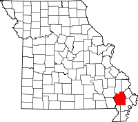 | |
| Villages | ||
| Townships | ||
| CDP | ||
| Other unincorporated communities | ||
| Ghost towns | ||