Bermonville
| Bermonville | ||
|---|---|---|
| ||
 Bermonville Location within Normandy region  Bermonville | ||
| Coordinates: 49°38′30″N 0°38′09″E / 49.6417°N 0.6358°ECoordinates: 49°38′30″N 0°38′09″E / 49.6417°N 0.6358°E | ||
| Country | France | |
| Region | Normandy | |
| Department | Seine-Maritime | |
| Arrondissement | Le Havre | |
| Canton | Saint-Valery-en-Caux | |
| Area1 | 7.41 km2 (2.86 sq mi) | |
| Population (2006)2 | 451 | |
| • Density | 61/km2 (160/sq mi) | |
| Time zone | UTC+1 (CET) | |
| • Summer (DST) | UTC+2 (CEST) | |
| INSEE/Postal code | 76080 /76640 | |
| Elevation |
122–145 m (400–476 ft) (avg. 136 m or 446 ft) | |
|
1 French Land Register data, which excludes lakes, ponds, glaciers > 1 km2 (0.386 sq mi or 247 acres) and river estuaries. 2 Population without double counting: residents of multiple communes (e.g., students and military personnel) only counted once. | ||
Bermonville is a former commune in the Seine-Maritime department in the Normandy region in northern France. On 1 January 2017, it was merged into the new commune Terres-de-Caux.[1]
Geography
A farming village situated in the Pays de Caux, some 25 miles (40 km) northeast of Le Havre, at the junction of the D926 and the D29. Junction 8 of the A29 autoroute is within the commune’s borders.
Heraldry
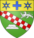 |
The arms of Bermonville are blazoned : Vert, a bend chequy argent and gules of 2 traits, between a lion passant and a motte and bailey argent, and on a chief Or, a crosslet between two spur rowels [mullets voided] azure. |
Population
| Year | 1962 | 1968 | 1975 | 1982 | 1990 | 1999 | 2006 |
|---|---|---|---|---|---|---|---|
| Population | 368 | 368 | 314 | 307 | 314 | 371 | 451 |
| From the year 1962 on: No double counting—residents of multiple communes (e.g. students and military personnel) are counted only once. | |||||||
Places of interest
- The church of Notre-Dame, dating from the twelfth century.
- A sixteenth century manorhouse
See also
References
- ↑ Arrêté préfectoral 12 September 2016 (in French)
External links
| Wikimedia Commons has media related to Bermonville. |
- Bermonville on the Quid website (in French)
This article is issued from
Wikipedia.
The text is licensed under Creative Commons - Attribution - Sharealike.
Additional terms may apply for the media files.